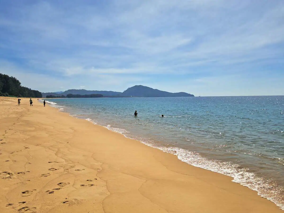
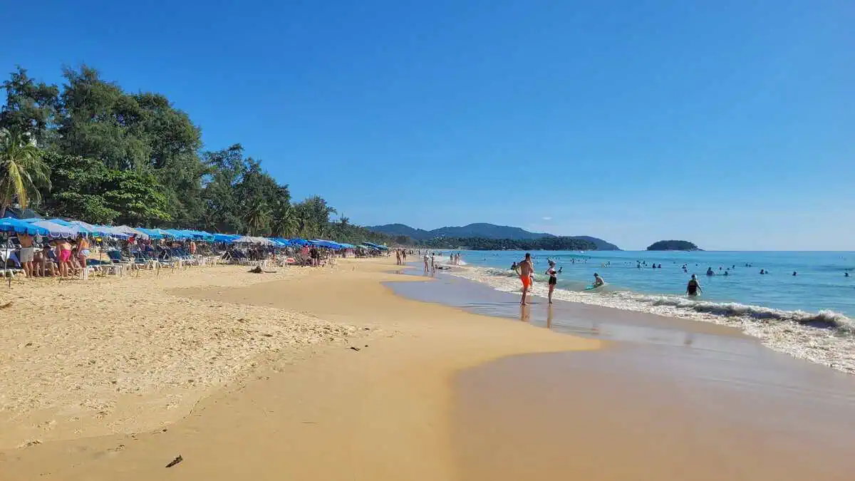
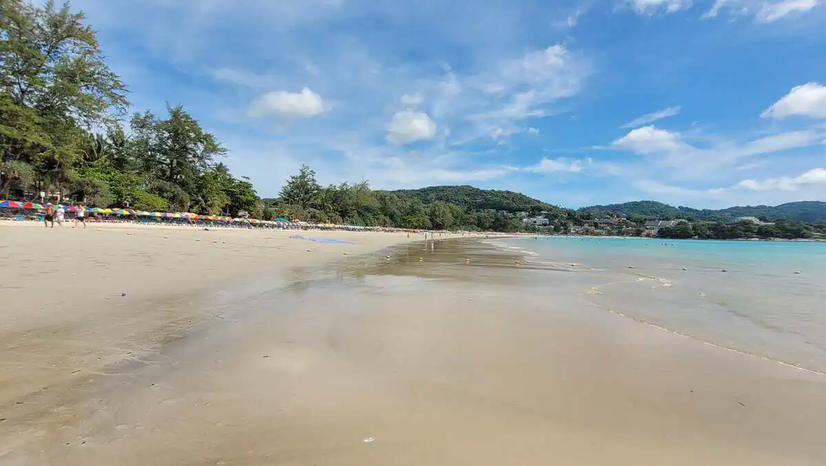
บางเทา · centre, the largest bay
8 km · Resorts · Water sports · Beach clubs · Clearance 2026
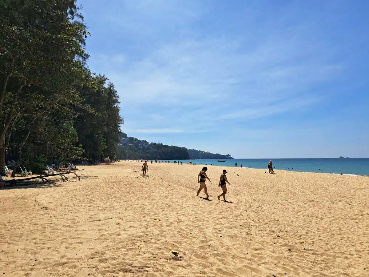
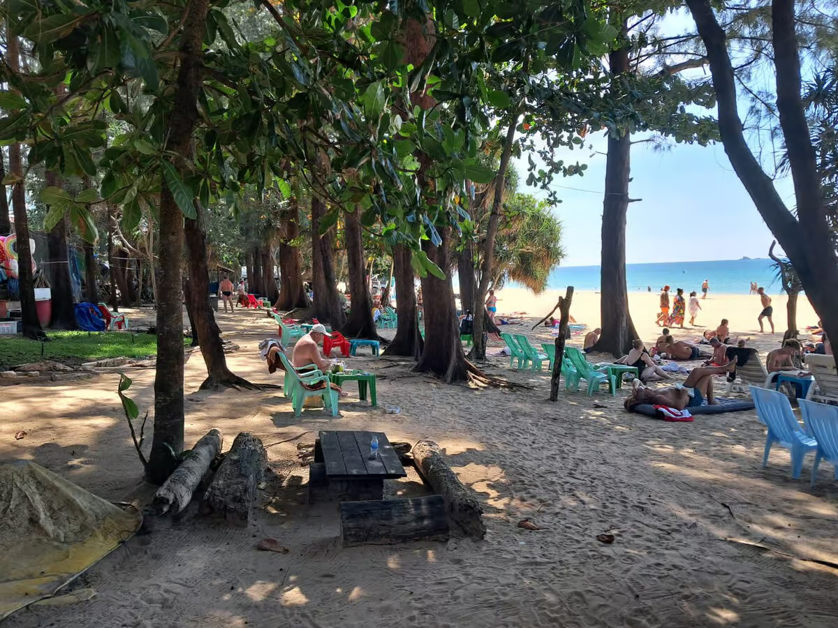
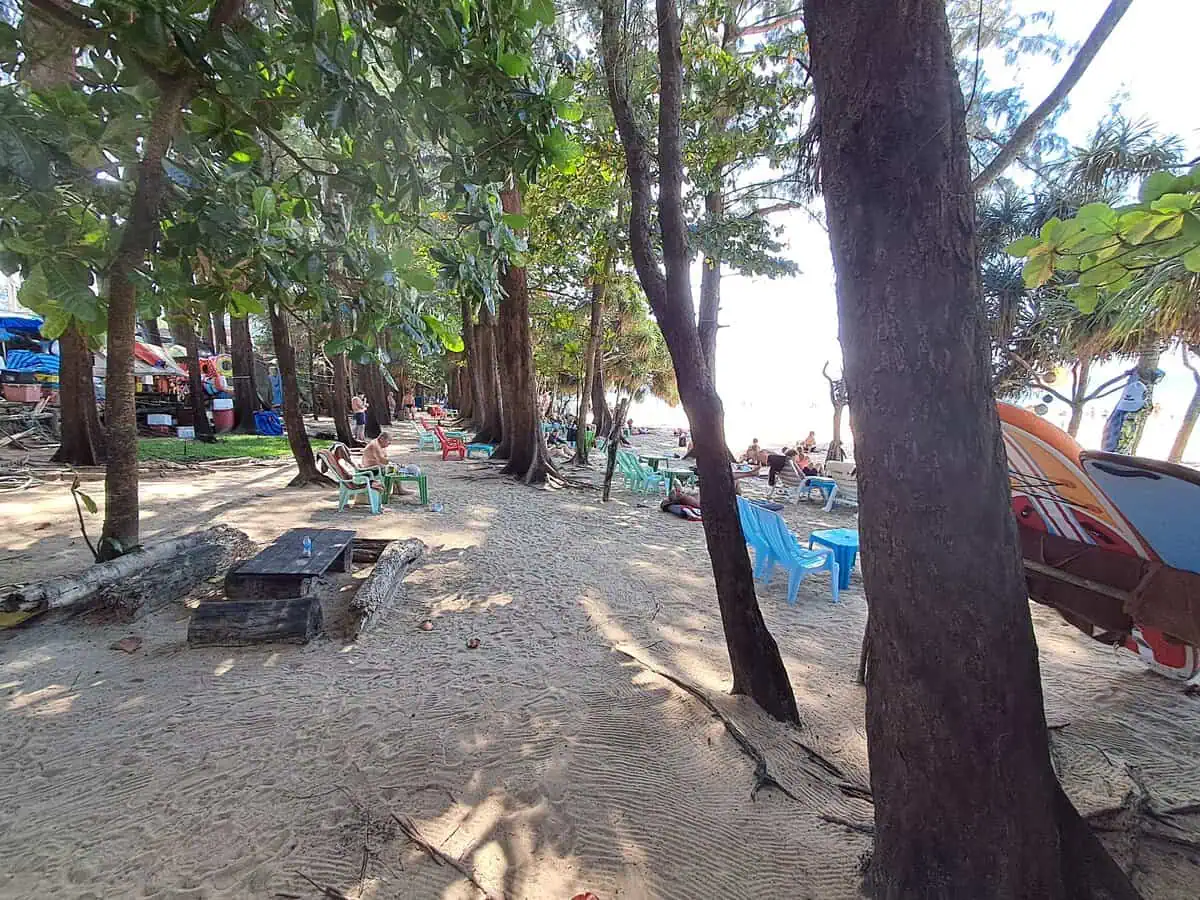
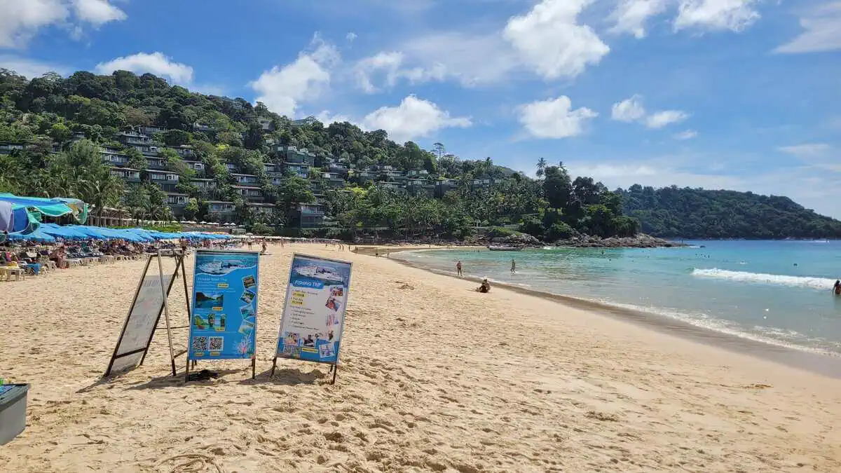
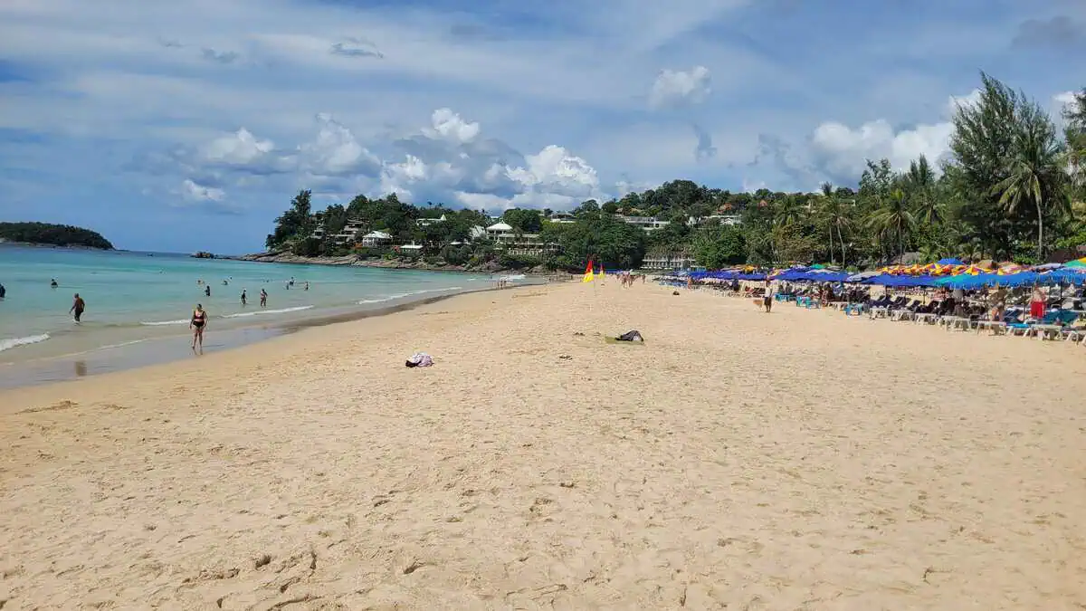
The beach of the big hotels: eight kilometres of sand, with the Laguna complex and its lakes and shuttle boats behind it. If you want infrastructure – sunbeds, beach clubs, water sports, restaurants within walking distance – this is the place.
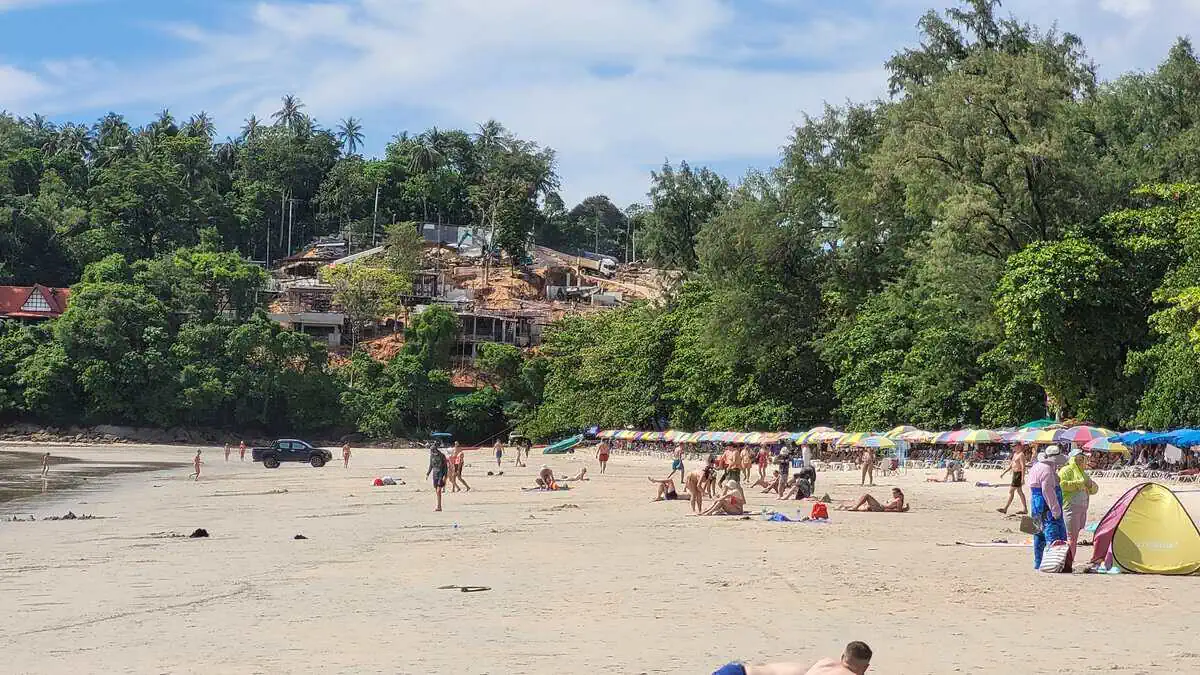
What happened in 2026: since April 2026 the authorities have been clearing structures built unlawfully on public beach land. The section south of SAii Laguna is mainly affected: after an inspection 16 businesses were closed there and more than 5 rai (about 0.8 hectares) of beach were recovered. Official notices forbidding entry hang on the buildings. Among those affected are Maya Beach Club, Nomad Beach Club, Beach Pig, Yuuhi Beach Club and Karaoke, Reggae Bar and Restaurant, Aloma Seafood and Alex’s Shack Bar.
What remains: the beach clubs Catch, Carpe Diem, RAVA and Xana and The Beach Phuket were still operating in October 2026, as were the restaurants in the resorts and the bamboo huts further north towards Layan. Catch is no longer in Surin, by the way – the club has moved to Bang Tao and been rebuilt.
What that means for you: if you want the beach without the hotel grounds, keep to the sections between the complexes – there the sand is free, quiet and empty in the morning. If you are looking for one particular beach club, ring ahead: older guidebooks and map entries still show places that no longer exist.
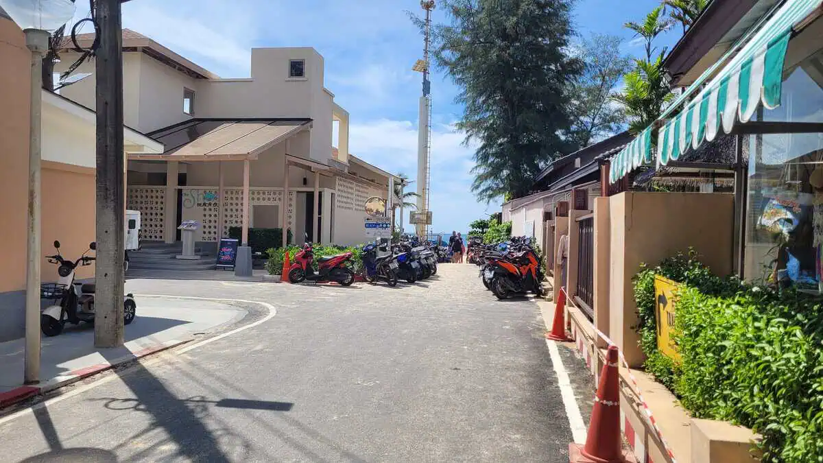
| Getting there | taxi, scooter, hotel shuttle |
|---|
| Parking | car parks at the accesses, full at peak times |
|---|
| Services | complete |
|---|
| Fee | none, food and drink expensive |
6. Layan / Le Phang
ลายัน · northern end of Bang Tao
Quiet · Access varies
The quiet counterpoint to Laguna: a long, natural stretch with casuarinas and fishing boats. The beach itself is public, but the paths to it have been the subject of legal disputes for years – individual accesses were closed and only reopened after court rulings or administrative decisions.
If you go, be prepared for a familiar path to have grown over or been fenced off, and do not climb over fences.
New in 2026: an officially approved landscaping project has started on the green strip between the Movenpick and Anantara Layan – parking areas, recreation and sports zones, set into the existing vegetation. The work is under way; the character of this stretch will change over the next few years.
| Getting there | your own car; accesses change |
|---|
| Parking | at the roadside |
|---|
| Services | next to nothing |
|---|
| Fee | none |
7. Laem Singh
แหลมสิงห์ · between Surin and Kamala
Snorkelling · Quiet · No road access · Boat only
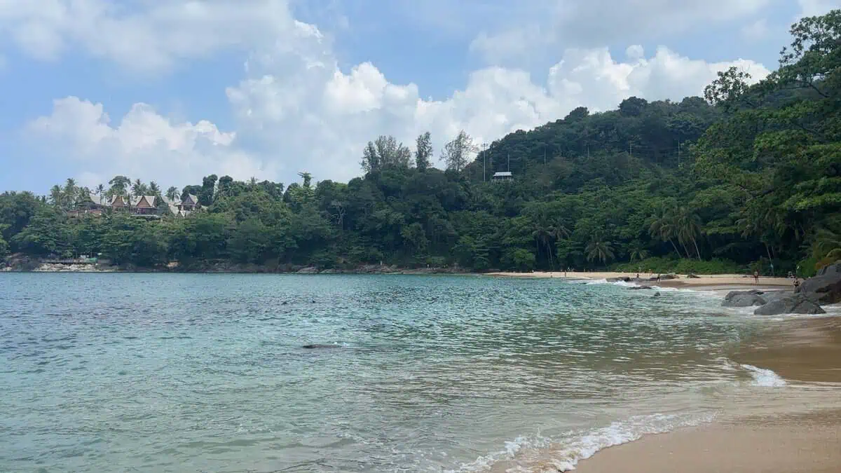
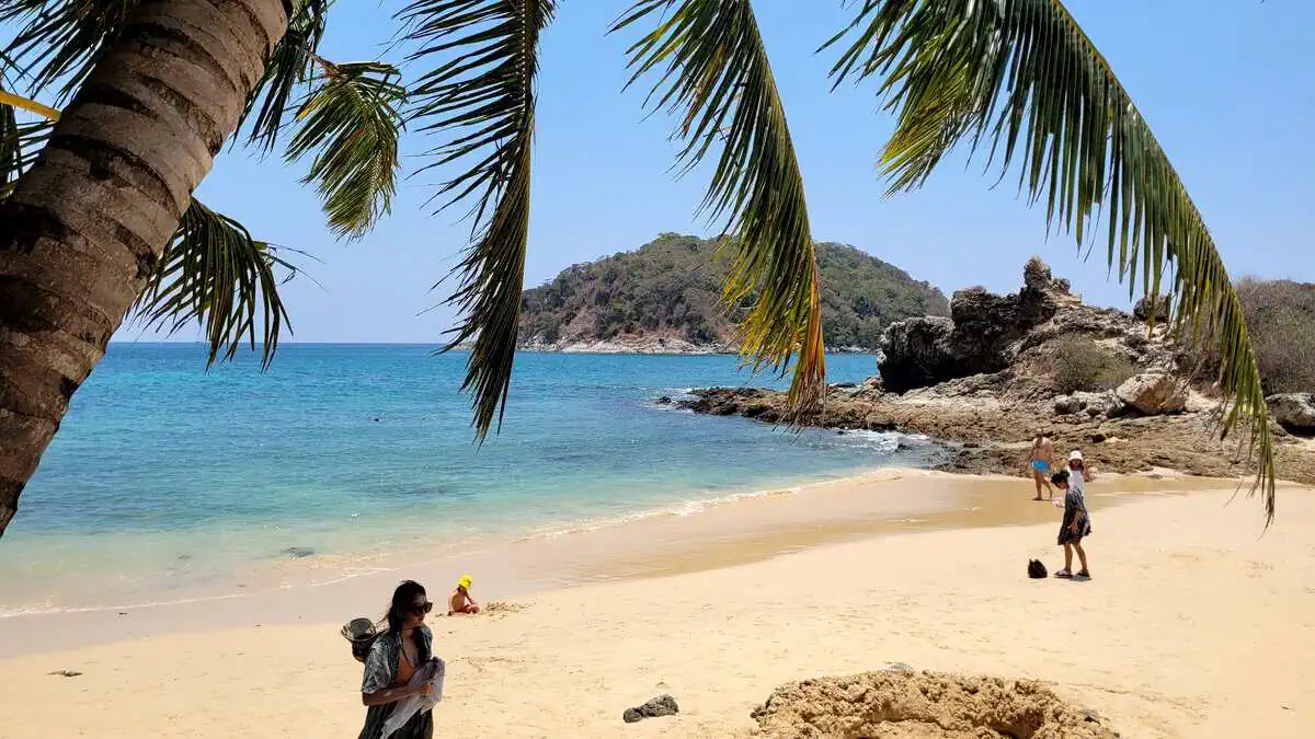
A palm-fringed bay that has not been reachable by road since 2017: a land dispute closed the stairway, and for years afterwards the only way in was over the water. Today you get there by boat from Surin – or on foot over the rocks in about 15 to 20 minutes.
The picture was taken from the water and shows exactly what makes the bay: a narrow strip of sand, large granite boulders on the right bank, and behind it the wooded slope running almost down to the water. On the headland above stand the big villas with their steep Thai roofs – they are the reason this slope was fought over.
The beach is public – every beach in Thailand is. Whoever gets here has one of the most photogenic bays on the island almost to themselves: no sunbed hire, hardly any traffic, clear water over rocky ground.
| Getting there | longtail boat from Surin, about 10 minutes |
|---|
| Alternative | rock scramble from Surin, 15-20 min, sturdy footwear |
|---|
| Parking | in Surin, then on foot or by boat |
|---|
| Services | none – no water, no toilet, no sunbed hire |
|---|
| Shade | under the trees at the edge |
|---|
| Snorkelling | good – rocky bottom, clear water |
|---|
| Fee | boat trip about 100-200 THB per person |
The access: why nobody drives here
แหลมสิงห์ · access
Stairway closed since 2017 · Boat · Rock path
A stairway used to lead down from the coastal road – it was the reason Laem Singh was a popular beach for decades. It was closed in 2017 in the course of a land dispute. Since then there have been two options, and both demand something of you:
Legally the beach is public – the way there is not necessarily. If you cross private land or climb over fences you risk trouble. Please do not.
- Boat from Surin: the relaxed option, about 10 minutes. The longtail boats stand on Surin beach; agree the price beforehand.
- Rock scramble from Surin: 15 to 20 minutes over the rocks, not advisable when it is wet or the sea is high. Sturdy footwear, and no luggage you cannot carry.
8. Surin
หาดสุรินทร์ · mittlere Westküste, zwischen Bang Tao und Kamala
หาดสุรินทร์ · central west coast, between Bang Tao and Kamala
Clear water · No sunbeds · No beach service · Shade under trees
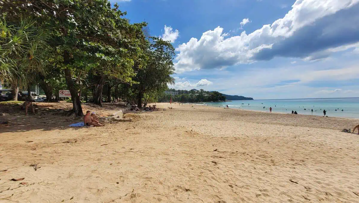
Surin has always counted as one of the most beautiful beaches on the island: soft sand, clear water, a wide arc between two hills, casuarinas and palms behind. If you have a picture in your head, though, it is usually the Surin of before 2016 – with beach clubs, sunbeds and a long row of restaurants.
This is how it looks today: since May 2025 all beach vendors and the restaurants on the beach have been removed again – the second clearance after 2016. Sunbeds and umbrellas are practically gone, and jet skis, massage and parasailing are prohibited by sign. You find shade under the trees. The water is clear and the current can be strong – on days with waves the flag system applies.
If you want to eat, go to the road behind the beach or the market by the car park. The atmosphere Surin was known for has gone with the clearances – in exchange the beach is as natural as it has not been for decades.
| Getting there | road from Bang Tao or Kamala, accesses signposted |
|---|
| Parking | car park at the northern end; some entrances blocked by concrete barriers |
|---|
| Services | none on the beach – restaurants and a market on the road |
|---|
| Sunbeds | none (cleared May 2025) |
|---|
| Shade | under casuarinas and palms |
|---|
| Toilets | public at the access, shower is a tap and a scoop only |
|---|
| Water | clear; watch for current and waves |
|---|
| Fee | none |
What has applied at Surin since 2025
หาดสุรินทร์ · regulations
Prohibition signs · Lifeguards · No commerce
The local council has put up coloured signs – so far in Thai only. According to them, jet skis, speedboats, sunbeds and umbrellas, food trucks, massage, stalls and roaming vendors are prohibited. What remains allowed is everything that costs nothing: swimming, lying on your towel, shade under the trees.
The situation changed twice, in 2016 and 2025 – and it can change again. If you specifically want to eat or rent a sunbed, check beforehand.
Surin: the right-hand section
Parking at Surin: the left-hand entrance
Parking at Surin: the right-hand entrance
9. Kamala Beach
กมลา · central section, village at the beach
Family-friendly · Village · Lifeguards · Sunset
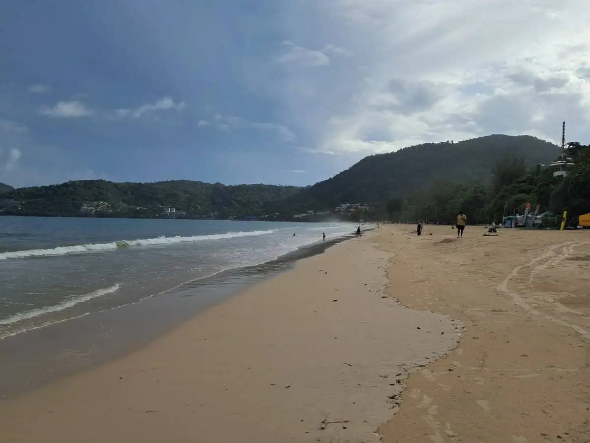
A beach with a real village behind it: fish restaurants, small shops, a tsunami memorial by the road. The water shelves evenly and lifeguards are on duty in season – one of the most straightforward beaches for families.
The northern section is quieter, the southern one closer to the hotels and restaurants. And if the weather plays along, Kamala is one of the few beaches on the west coast where the sun actually sets over the sea – the bay opens to the west, with no hills in the way.
| Getting there | taxi or scooter, easy to reach |
|---|
| Parking | roadside, usually possible |
|---|
| Services | complete |
|---|
| Fee | none |
|---|
| Sunset | yes – the bay opens to the west |
Kamala: sunset over the sea
กมลา · evening
Sunset · Jet ski traffic · Evening crowds
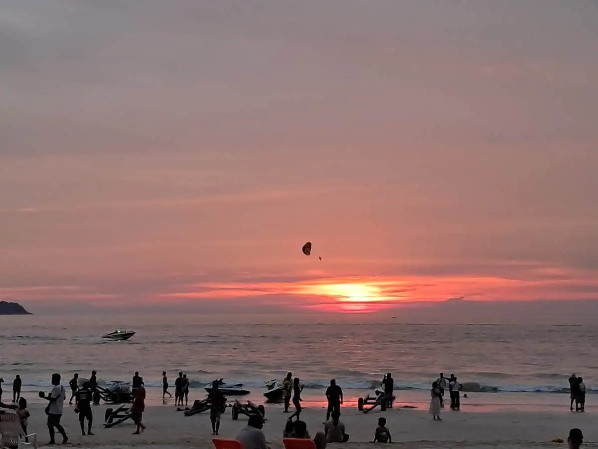
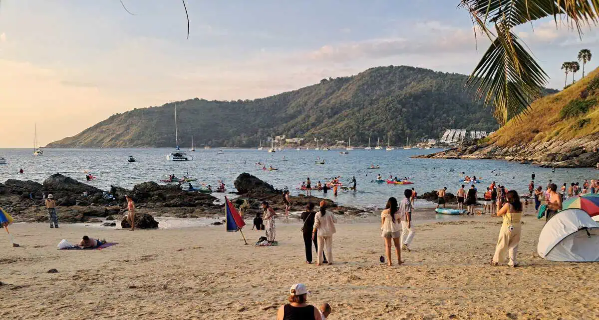
The reason many people come to Kamala in the evening: here the sun really does set on the horizon, not behind a ridge. When the air is clear the whole sky changes colour, and dozens of people stand at the water with their phones.
What the picture also shows: the beach is not a quiet place in the evening. Jet skis are driven up to the shore, vendors are out, and it is loud. If you want quiet, go to the northern section or walk a few minutes to the neighbouring bay.
| Best time | 17:45-18:45, depending on the season |
|---|
| Bring | nothing – drinks and snacks are available by the road |
|---|
| Please note | jet ski and boat traffic near the shore, keep an eye on children |
10. Kalim Bucht
กะหลิม · zwischen Kamala und Patong
กะหลิม · between Kamala and Patong
Quiet · Rocks · No crowds
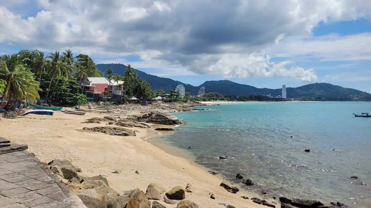
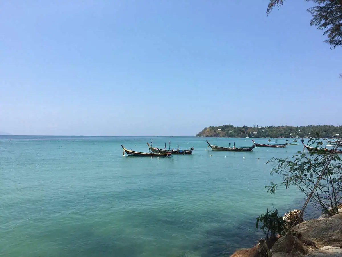
Kalim is the small, often overlooked beach directly north of Patong: a shallow bay with rock slabs at both ends, little sand at low tide and none of the beach clubs its neighbour is famous for. If you are staying in Patong and want two hours away from the crowds, you are here in five minutes.
The photo shows the view south: the quiet bay with longtail boats and rock slabs on the left, the high-rise hotels of Patong behind. Two beaches, five minutes apart, two completely different worlds – Kalim is hard to explain any better than that.
| Getting there | taxi or scooter from Patong, 5 minutes |
|---|
| Parking | roadside, limited |
|---|
| Services | a few small shops; a restaurant in the evening (Baan Rim Pa) |
|---|
| Fee | none |
|---|
| Lifeguards | no permanent cover |
|---|
| Sunset | popular photo subject with Patong as a backdrop |
11. Patong Beach
หาดป่าตอง · zwischen Kamala und Karon, die größte Bucht
หาดป่าตอง · between Kamala and Karon, the largest bay
3 km of sand · Lifeguards · Full service · Current in the north · Loud at night
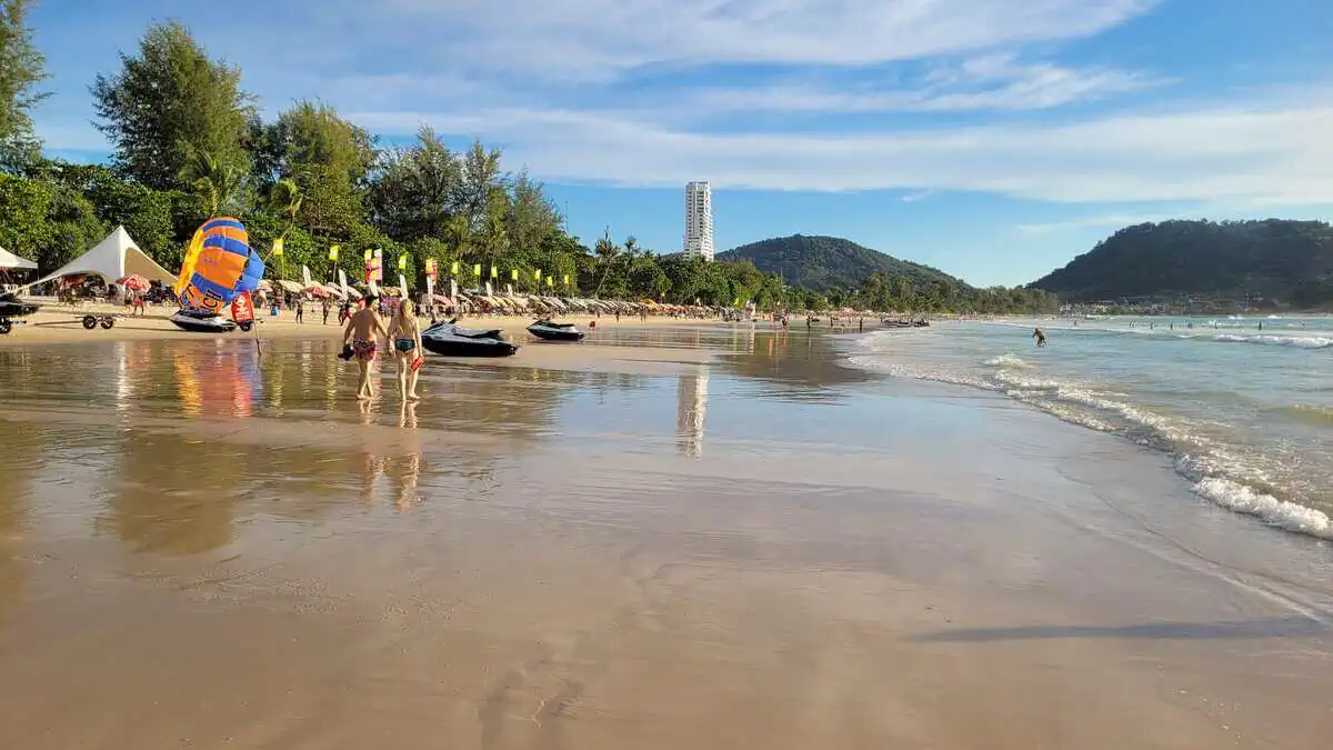
Patong is the beach everybody knows – and the one that cannot be left out of an honest overview. Three kilometres of sand in a wide bay, the road with hotels, shops and restaurants behind it, and Bangla Road at night. If you associate Phuket with crowds, you mean Patong.
The beach itself is better than its reputation. It is divided into two areas: a section with sunbeds and umbrellas (two sunbeds with an umbrella around 200 THB per day) and a free area for anyone who brings their own mat. Natural shade is scarce – the few trees are taken early.
Safety: Patong is the best supervised beach on the island – lifeguards from roughly 8 to 18, with a green-amber-red flag system. At the same time most swimming accidents happen here, simply because of the numbers. The northern tip towards Kalim has permanent currents – do not go in there when the sea is building.
| Length | about 3 km |
|---|
| Swimming | usually calm Nov-Apr; current and surf May-Oct |
|---|
| Supervision | lifeguards about 8-18, flags |
|---|
| Danger | northern tip towards Kalim – permanent current |
|---|
| Sunbeds | 2 sunbeds plus umbrella about 200 THB per day; free section available |
|---|
| Shade | scarce – few trees, taken early |
|---|
| Services | complete – food, drinks, water sports, massage |
|---|
| Parking | along the shore road; scarce in high season |
|---|
| Fee | none |
|---|
| At night | Bangla Road – loud, into the early hours |
12. Freedom Beach
หาดฟรีดอม · zwischen Patong und Karon
หาดฟรีดอม · between Patong and Karon
Snorkelling · Quiet · Cleared in 2026
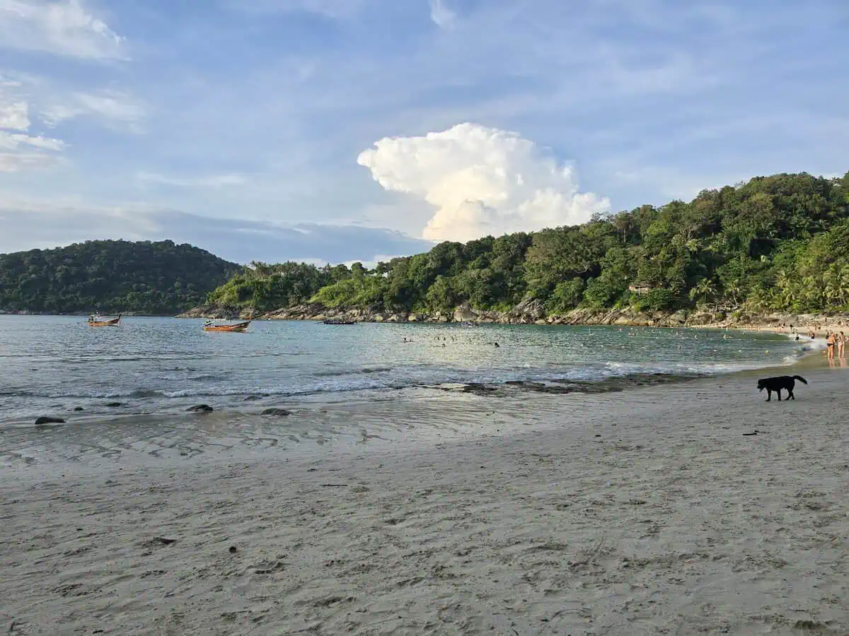
A bay 300 metres long, enclosed by hills, with bright quartz sand – no road, no rows of sunbeds, no jet skis. That is exactly why it is one of the most beautiful beaches on the island: you get in only by boat from Patong or down a steep jungle path.
A lot changed here in 2026. The authorities added the beach to the campaign to recover public land: in July 2026 a clearance order was issued against 22 structures on about 9 rai of woodland, and in August the beach was temporarily closed after a fatal swimming accident. At the same time it was promised that the access path would be repaired and that no admission fee would be charged any more.
| Getting there | longtail boat from Patong (10-20 min) or the jungle path |
|---|
| Parking | at the junction above, chargeable |
|---|
| Services | reduced after the clearance; toilets available |
|---|
| Fee | reported to have been dropped – carry cash anyway |
|---|
| Lifeguards | none |
Freedom Beach: the second view
หาดฟรีดอม · view to the right
Clear water · Little traffic
The other half of the bay: shallow entry, calm water, a few longtail boats – and a beach dog that clearly counts as part of the furniture here. At the left and right rocky ends there is a small reef within reach from the shore.
| Water | sheltered, shallow entry |
|---|
| Snorkelling | at both rocky ends |
|---|
| Please note | no lifeguards, do not swim when there is a swell |
The way down
หาดฟรีดอม · access on foot
Steep · Sturdy shoes · No shade on the way back
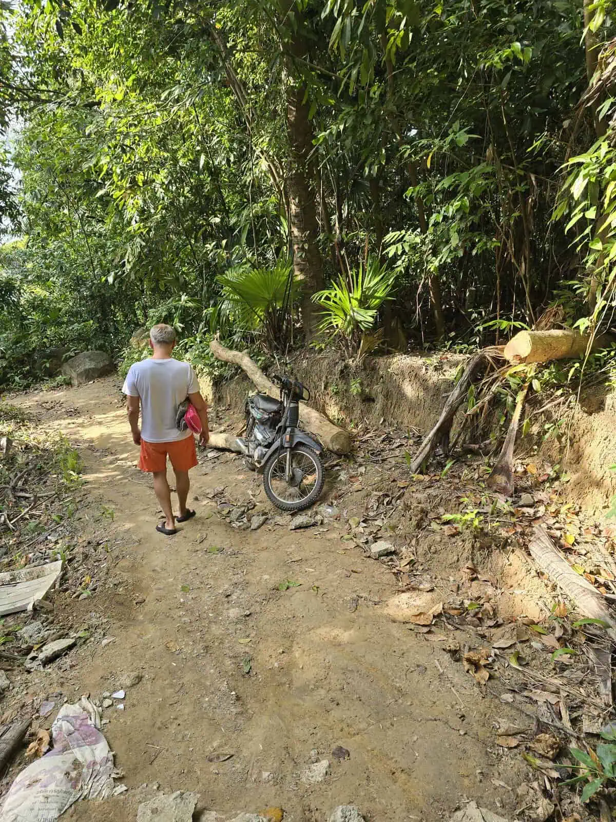
The climb is the real price of this beach: earth steps, roots, loose stones – slippery when wet, exhausting in the midday heat. Going back up takes noticeably longer than going down.
Sturdy shoes rather than flip-flops, take water, phone in your pocket. The scooter at the edge shows how locals ride the stretch – not a good idea for visitors.
| Duration | 15-25 min down, 20-35 min back up |
|---|
| Difficulty | moderate to demanding |
|---|
| Not suitable for | small children, pushchairs, walking aids |
The shrine beside the path
ศาลพระภูมิ · edge of the path
Culture · Respect
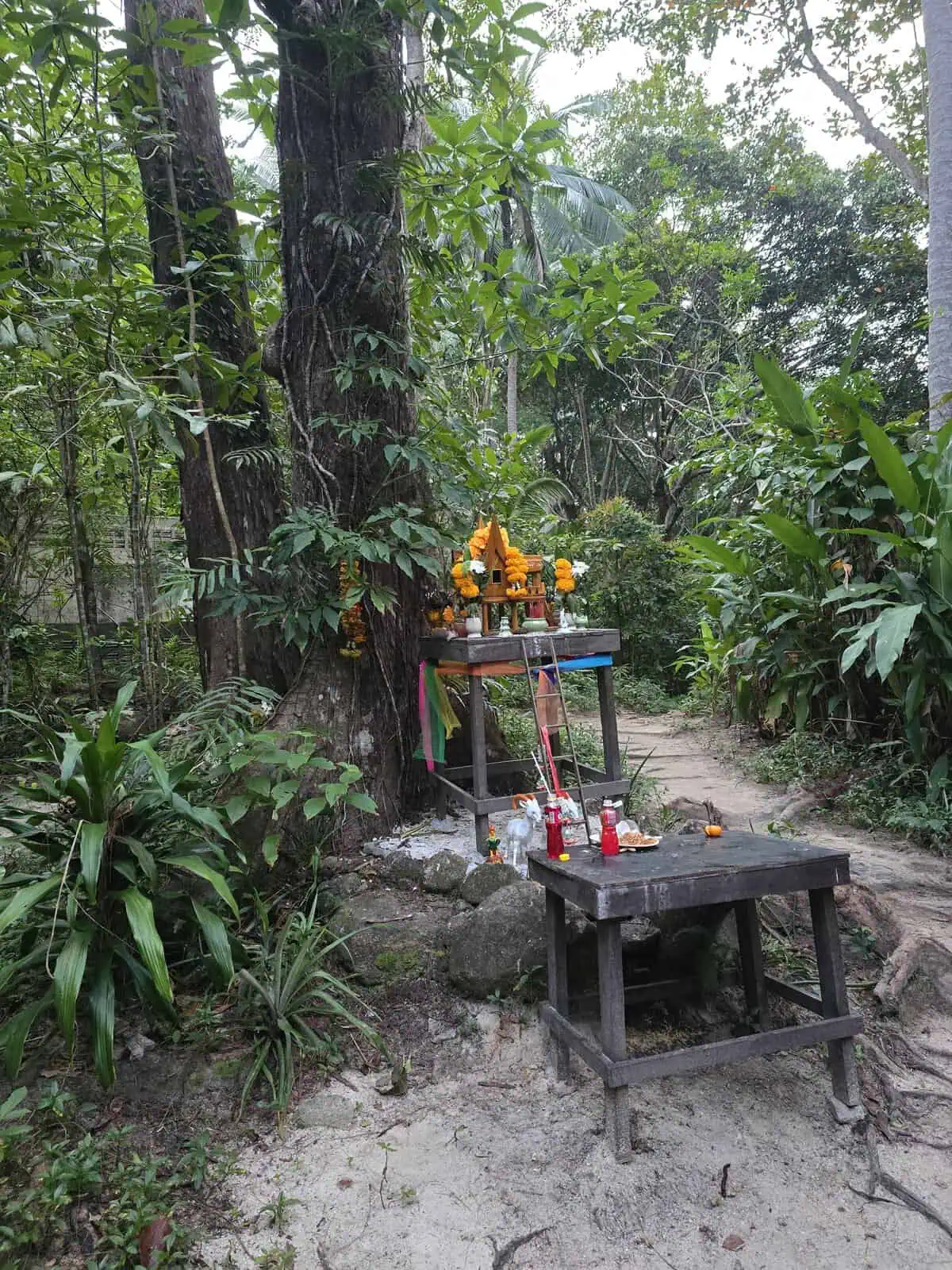
Shortly before the path drops into the wood there is a spirit house (ศาลพระภูมิ) under the trees – flower garlands, drink bottles, offerings. For many Thai people it marks the transition into a place you approach with respect.
Photographing is fine, but not from above and not with your back turned. If you want to add flowers, you can – it is appreciated.
| Important | do not touch the shrine, do not take the offerings |
|---|
| Photography | allowed, respectfully and without flash |
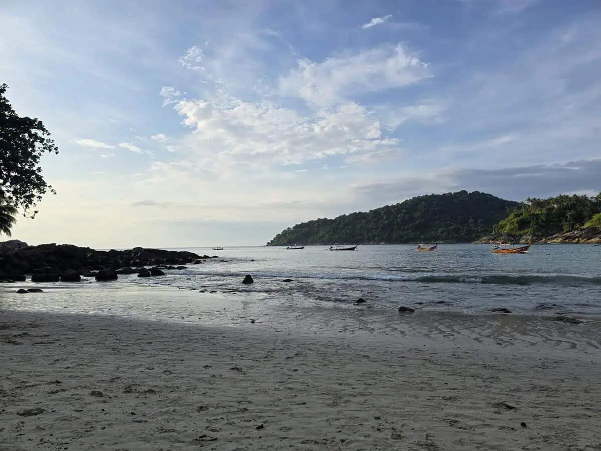
Evening light in the bay
หาดฟรีดอม · evening
Sunset · Quiet · Way back in the dark
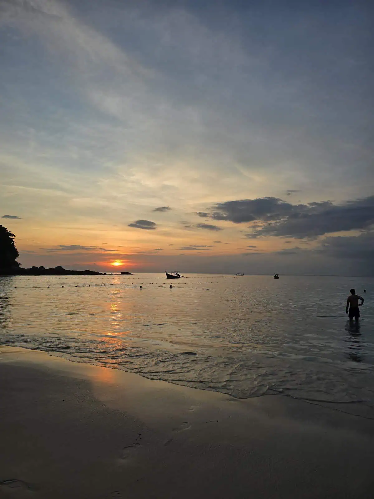
The evening is the loveliest time in the bay – calm water, warm light, hardly anyone left. The catch: climbing the jungle path in the dark does you no favours. Take a torch or take the boat back.
| Best time | 17:30-18:30, depending on the season |
|---|
| Careful | the path is unlit – take a torch or the boat back |
13. Karon Beach
หาดกะรน · between Patong and Kata
3 km long · Family-friendly · Umbrellas · Lifeguards
Karon is the long, open beach between Patong and Kata: three kilometres of fine yellow sand, a road with restaurants and shops directly behind, hills in the north and a view of the offshore island rock in the south. This is the classic holiday format – rows of umbrellas, sunbed hire, beach vendors, lifeguards.
The waves are usually stronger than at Nai Harn or Kamala; when the sea builds, the amber or red flag goes up. If you want it calmer, head for the southern section – or drive the few minutes on to Kata (shallow water, hardly any waves) or Kata Noi, where the bay is more sheltered still.
| Getting there | taxi, scooter, easy to reach |
|---|
| Parking | plenty, but chargeable |
|---|
| Services | complete (sunbeds, food, massage) |
|---|
| Fee | none for the beach; sunbeds about 100-200 THB |
|---|
| Waves | often stronger – watch the flags |
Karon: beach business and lifeguards
หาดกะรน · panorama
Lifeguards · Hire · Flags
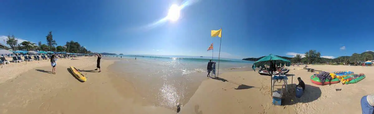
The panorama shows the organised part of Karon: rows of umbrellas on the left, kayaks and surfboards on the sand, and on the right the post with the amber flag – caution, swim with restrictions. If you do not know the flags: red means no swimming, and here it is enforced.
| Hire | kayak, surfboard, sunbeds on the beach |
|---|
| Flags | amber = caution, red = no swimming |
|---|
| Please note | supervision only inside the marked area |
14. Kata Beach
หาดกะตะ · Süden, zwischen Karon und Kata Noi
หาดกะตะ · south, between Karon and Kata Noi
Family-friendly · Hardly any waves · Toilets 20 THB · Sunbeds 200 THB
Kata is the beach that comes closest to the cliche: a wide arc of pale sand, the road with restaurants and shops directly behind, rows of umbrellas at the edge and water that runs in so shallow on a calm day that you can wade a long way out. On the day we visited the sea was calm and swimming was allowed.
Practical: the road on the beach side is a one-way street – that is the most common mistake on the way here. Parking, on the other hand, is surprisingly relaxed: along the long wall of Club Med on Beach Road there were plenty of free spaces for car and scooter.
| Getting there | via Karon; note the one-way street on the beach side |
|---|
| Parking | free, plenty along the Club Med wall |
|---|
| Toilets | at the right-hand edge by the entrance – 20 THB |
|---|
| Other toilets | none in the middle section |
|---|
| Sunbeds | 2 sunbeds plus umbrella 200 THB |
|---|
| Shade | some under the few palms towards the road |
|---|
| Waves | hardly any – swimming possible |
|---|
| Beach fee | none |
Kata: the shallow north end
หาดกะตะ · view north
Shallow water · Families · Offshore island
The northern part shows why Kata is popular with families: a wide shallow zone where children can stand easily, with the small offshore island in front. At low tide the walk to the water is long – water shoes are no bad idea.
| Water | shallow, hardly any waves |
|---|
| Suitable for | families, weaker swimmers |
|---|
| Please note | rocks and the island in the north – take care at high tide |
Parking on Beach Road
หาดกะตะ · parking
Free · Plenty of spaces · One-way street
Along the outside of the long Club Med wall there is a long free row of parking spaces – for scooters right at the edge, for cars on the road side. That is considerably more comfortable than Kata Noi, where the spaces along the hotel wall are often blocked.
Important on the way here: the road on the beach side is a one-way street. Turn in the wrong way and you are quickly facing oncoming traffic.
| Cost | free |
|---|
| Location | outside the Club Med wall, Beach Road |
|---|
| Please note | one-way street – approach from the north |
Construction at the right-hand edge
หาดกะตะ · building site
Building site · Not audible in the middle
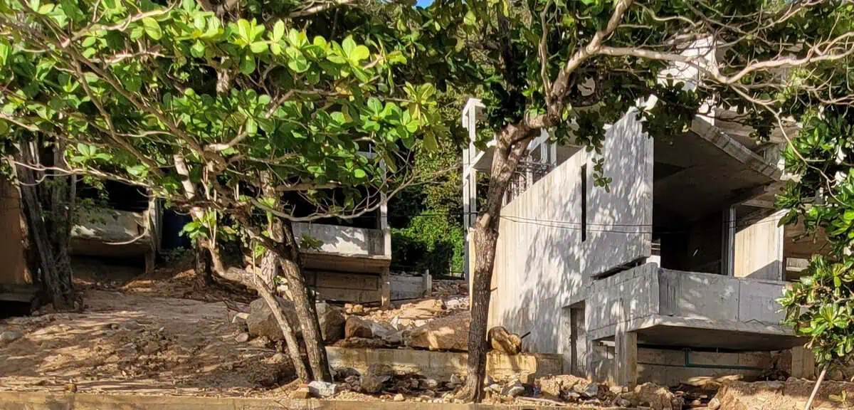
A hotel complex is being built at the right-hand (southern) edge of the beach: earthworks, unfinished buildings, cranes on the slope – visible above the rows of umbrellas. In the middle section of the beach nothing could be heard.
If you want absolute quiet, put yourself in the middle or to the north. If you are only there to swim, you will barely notice.
| Location | right-hand / southern edge of the beach, on the slope above |
|---|
| Impact | visible, but not audible in the middle of the beach |
|---|
| Recommendation | choose the middle or the north if you want quiet |
15. Kata Noi
กะตะน้อย · south, Kata’s little sister
Clear · Hotel slope · Little parking · Toilets 40 THB
The small, finer half of Kata: a curving beach between hills, few hotels, no through road, and clear water with often calmer seas than at its bigger neighbour. Behind it the slope with the hotel villas rises – the picture shows both: rows of umbrellas on the left, villas above, turquoise water in front.
The beach is popular and correspondingly full on good days. Shade is the main problem: there is hardly any natural shade, and if you do not rent a sunbed you sit in the sun.
| Getting there | via Kata, short steep access road |
|---|
| Parking, car | very little – outside along the long hotel wall |
|---|
| Parking, scooter | few spaces by the road (see photo) |
|---|
| Toilets / shower | available, 40 THB (outside, at the access) |
|---|
| Sunbeds | 2 sunbeds plus umbrella 200 THB |
|---|
| Shade | scarce – no shade without renting a sunbed |
|---|
| Beach fee | none |
Kata Noi: the long view
กะตะน้อย · view north
Clear water · Shallow entry · Full row of umbrellas
The view north shows the whole bay: shallow entry, clear water, densely packed rows of umbrellas on the right edge and the hotels sitting among palms on the slope. In this picture the lifeguard flag stands just behind the middle – pay attention to it when there is a swell.
| Water | clear, shallow entry |
|---|
| Activity | rows of umbrellas on the right-hand half of the beach |
|---|
| Please note | watch the flags, rocks and reef in the south |
Getting there and parking
กะตะน้อย · access
Few spaces · Scooters have the advantage · Barriers
The access road is short and narrow. For cars there is practically only the option of parking outside the long hotel wall – and those spaces are often blocked with red-and-white traffic cones and tuk-tuks.
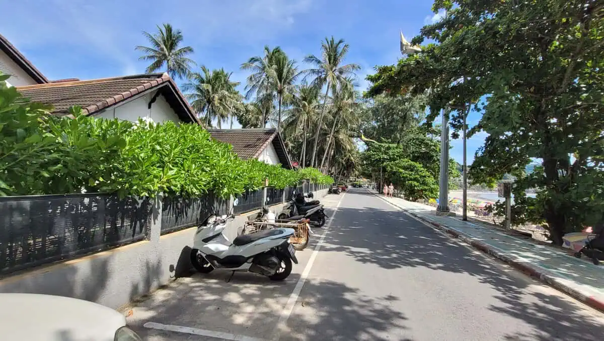
For scooters there are a few marked spaces right by the road (see picture). If you come by car, be there early and be prepared to walk a bit.
| Recommendation | scooter or taxi rather than a hire car |
|---|
| Car | only outside the hotel wall, often blocked |
|---|
| Best time | before 10 o’clock |
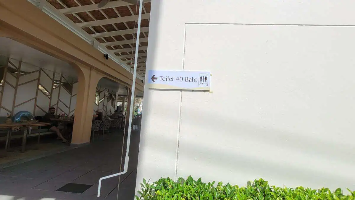
Toilets and showers: 40 THB
ห้องน้ำ · at the access
Sanitary facilities · 40 THB · Well kept
At the access there are renovated sanitary rooms with toilets and showers. The price is clearly signed at 40 THB – no haggling, no hidden costs. For a beach with sunbed hire and hotel guests, that is the usual rate.
Practical: if you are spending the day on the beach, keep some change with you – the 40 THB is charged per use.
| Price | 40 THB (toilet and shower) |
|---|
| Location | at the access, inside the complex |
|---|
| Condition | clean and well kept (as of 4 November 2026) |
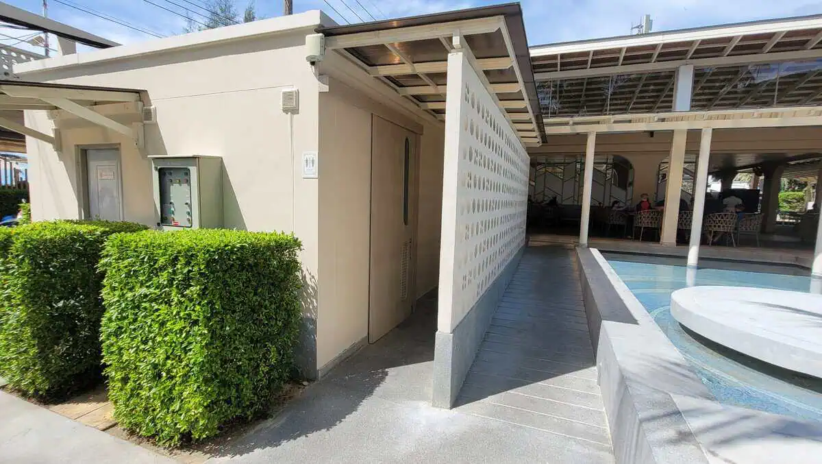
The building at the access
ห้องน้ำ · building
Well kept · Shade · Water dispenser
The building with the sanitary rooms sits right by the passage to the beach – privacy screen, hedges, a covered area with seating and a water tank. If you need a break from the sun, you can find shade here for a few minutes without ordering anything.
| Location | right at the beach access |
|---|
| Practical | shade and water without having to buy anything |
16. Nai Harn Beach
ในหาน · south, lake and temple behind
Sunset · Snorkelling · Families
The most popular beach in the south – and rightly so: a wide arc, a freshwater lake behind it, a temple, plenty of small restaurants and a promenade to stroll along in the evening. At the southern rocky end there is a reef within reach from the shore.
At low tide the sand runs a long way out; do not underestimate the current at the southern end. And if you want to get to the neighbouring Ao Sane: the kayaks start from here – 20 to 30 minutes in calm seas, with no argument about access roads.
| Getting there | taxi or scooter, easy to reach |
|---|
| Parking | car parks and roadside, busy |
|---|
| Services | complete |
|---|
| Fee | none |
17. Nui Beach and Ya Nui Beach
หาดยะนุ้ย · southern tip, between Nai Harn and Promthep Cape
Snorkelling from the shore · Kayak to Koh Man · Small and busy · Parking scarce
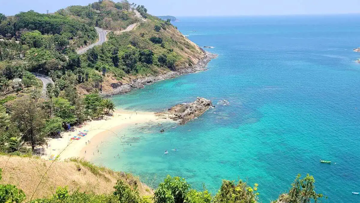
Ya Nui is a tiny bay – barely 120 metres wide – between Nai Harn and Promthep Cape. That is exactly what makes it so good: rocks at both ends, sand and clear water between them, and one of the few places on Phuket where snorkelling straight from the shore is worth it.
The rocks on the left have reef fish, sea urchins and small coral heads. The real highlight lies 300 metres out: the small island of Koh Man. Between the beach and the island there are healthy corals, anemones with clownfish, and visibility noticeably better than right at the beach. Kayaks are available on the beach for about 100 THB per hour per person.
Important: the crossing to Koh Man is over open water, and boats from Rawai pass through the area. That is one for experienced swimmers – not for children. The beach itself, by contrast, is shallow and calm.
| Getting there | between Nai Harn and Promthep Cape, on the coastal road |
|---|
| Parking | right at the beach, but very limited |
|---|
| Sunbeds | available, plus shade under the trees |
|---|
| Hire | snorkelling gear and kayak (about 100 THB per hour per person) |
|---|
| Snorkelling | very good – rocks on the left, better still: the crossing to Koh Man |
|---|
| Koh Man | 300 m across open water – experienced swimmers only |
|---|
| Food | small restaurants across the road |
|---|
| Beach fee | none |
Ya Nui in the evening
หาดยะนุ้ย · evening
Evening light · Kayaks · Busy
In the late afternoon the picture flips: the bay fills with visitors coming back from Promthep Cape, kayaks and paddleboards lie in the water, sunbeds are cleared away. For a beach this size that is a lot – Ya Nui is small and fills up accordingly quickly.
If you want to experience the bay quietly, come in the morning: the sea is clearest then, visibility for snorkelling is at its best and the beach is almost empty.
| Best time | early morning – clear water, no crowds |
|---|
| Evenings | busy, parking difficult |
|---|
| Photography | view back onto the hills in the evening light |
18. Nui Beach
หาดนุ้ย · hidden bay near Kata
Snorkelling · Very quiet · Not to be confused with Ya Nui
Nui Beach is not Ya Nui. The two are constantly confused because the names sound almost the same – but they are two different bays: Ya Nui lies by Nai Harn, Nui Beach lies hidden behind Kata, reachable only over a rough track.
The bay is small, framed by boulders, the water inside usually calm and clear. Snorkelling is worthwhile at the rocks left and right – but bring your own gear: after the 2026 clearance there is no hire on the beach any more.
Getting there: do not drive a hire car or scooter down to the water – park at the top, then walk or take the 4×4 shuttle down (about 200 THB return). If you walk, you need sturdy shoes and water; the descent is hot and without shade.
| Getting there | car park up on the road, then on foot or by 4×4 shuttle |
|---|
| Parking | upper car park, free |
|---|
| Services | none – no hire, no cafe, no water |
|---|
| Bring | water shoes, drinking water, your own snorkelling gear, cash |
|---|
| Snorkelling | good – boulders to the left and right of the bay |
|---|
| Supervision | lifeguard with flag (see picture below) |
|---|
| Beach fee | none – admission charges are not permitted |
|---|
| Shuttle | 4×4 from the upper car park, about 200 THB return |
|---|
| Alternative | longtail from Kata or Karon, 1,000-1,500 THB per boat |
Nui Beach: flag, lifeguard, shallow water
หาดนุ้ย · beach operations
Lifeguards · Flag system · Shallow entry
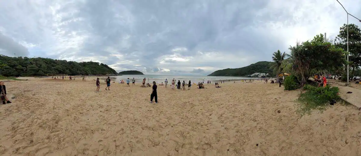
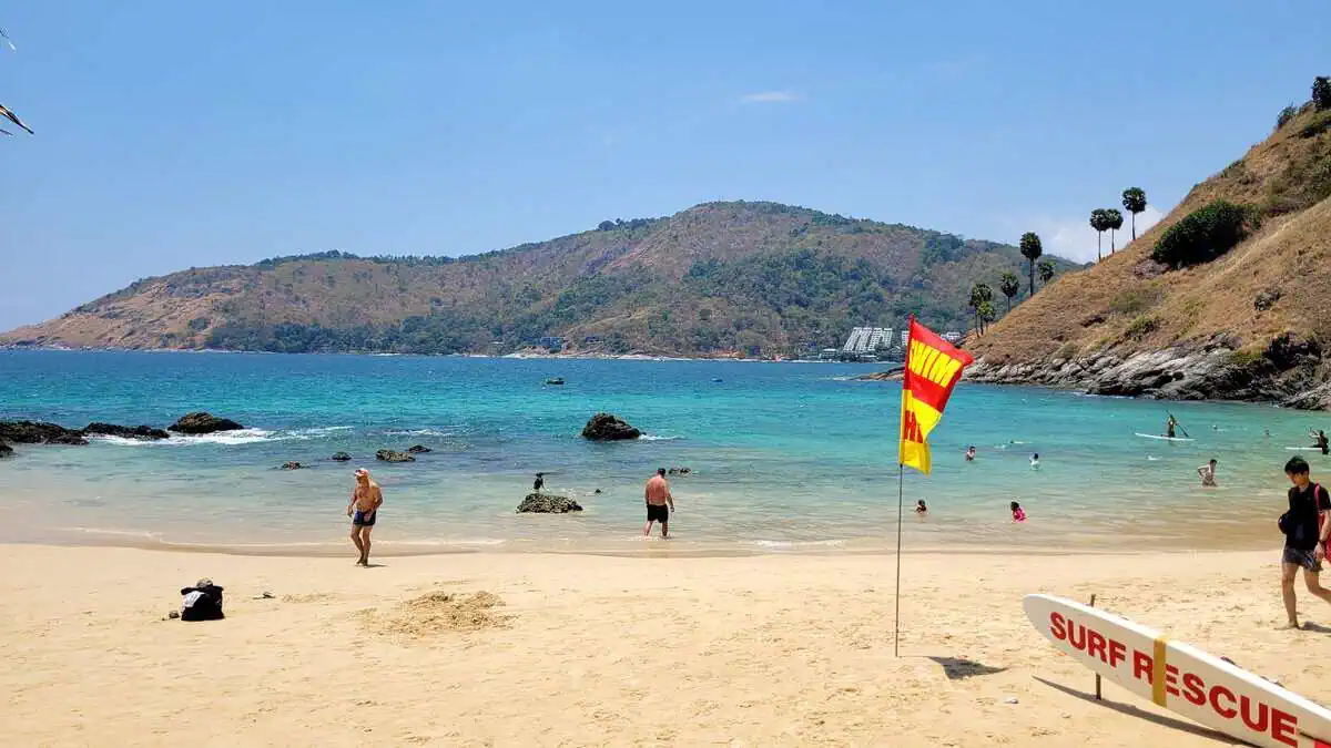
The picture shows something you do not expect at a hidden bay: a lifeguard with a flag and rescue board. The red-and-amber flag stands on the beach, the board lies ready in the sand, and families with children are in the shallow water.
That is an important addition to the picture: Nui Beach is remote and without services – but on the beach itself someone is watching. The flag system applies here too: red-amber means supervised, and with a red flag you stay out of the water.
| Supervision | lifeguard with flag and rescue board |
|---|
| Flag | red-amber = supervised; red flag = no swimming |
|---|
| Water | shallow entry, usually calm inside the bay |
|---|
| Please note | boulders in the water – water shoes recommended |
19. Ao Sane Beach
อ่าวเสน · Süden, drei kleine Buchten
อ่าวเสน · south, three small coves
Best shore reef · Quiet · Building site
The small bay north of Nai Harn is the best snorkelling spot on the west coast that you can reach without a boat: granite boulders, clear water, coral gardens from two metres down. The restaurant and bungalows have been demolished, and there has been no service since.
For years the access has led across an open building site: two construction sites, no continuous hoarding in between, no indication whether you are walking on a public path. If you want to avoid that, come over by kayak from Nai Harn.
Getting there up the hill behind The Nai Harn, then on foot
Parking few spaces above, tight
Services none
Fee none
20. Tri Trang
หาดตรีตรังค์ · south of Patong, at the end of the bay
Quiet · No services · Rocky shore · Hammocks
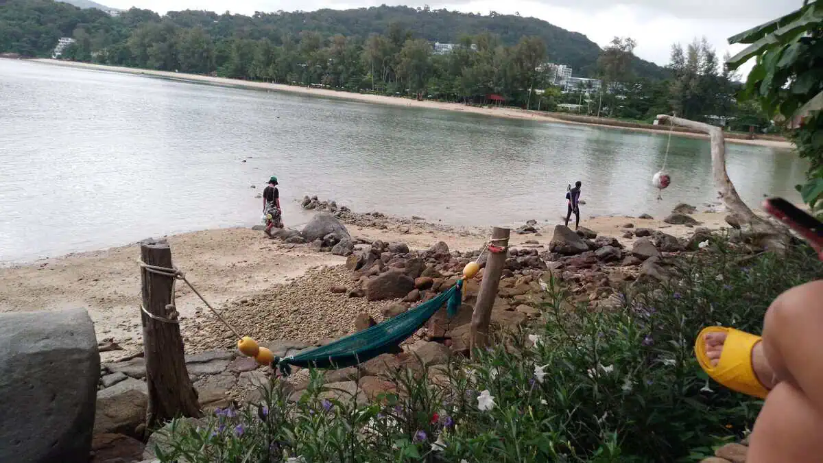
Tri Trang is the counter-design to Patong, even though it is only a few minutes away: a small bay at the southern end, reached by the road that climbs behind Patong. No sunbed hire, no rows of umbrellas, no music – instead rock slabs at the shore, trees down to the sand and the view back onto the wooded coast.
The sand is coarse and mixed with stones, so choose carefully where you enter the water. If you are looking for shade and somewhere to sit, you will find it under the trees and in the hammocks strung between wooden posts – they belong to the adjoining accommodation, not to the beach.
| Getting there | along the road south of Patong, winding |
|---|
| Parking | few spaces by the road |
|---|
| Services | none on the beach; restaurants in the hotels |
|---|
| Shore | rock slabs and stones – water shoes recommended |
|---|
| Suitable for | quiet, snorkelling at the rocks, sunset |
|---|
| Not suitable for | families with small children, sunbed holidaymakers |
|---|
| Fee | none |
21. Rawai
หาดราไวย์ · Südspitze, arbeitender Hafen
หาดราไวย์ · southern tip, a working harbour
Not a swimming beach · Seafood · Boats to the islands · Tides
Rawai is not a beach for swimming. That is the most important sentence you can say about the place – and the reason it still belongs in a beach overview: as a bay Rawai is lovely, as a place to swim it is unsuitable.
The bay lies at the southern tip, is shallow, and at low tide the water draws back 50 to 100 metres – leaving rock slabs, seagrass and mud exposed. On top of that, dozens of longtail and speedboats lie in the water, leaving from here for the islands (Coral Island, Koh Bon, Racha). Swimming between the lines is not sensible.
What you come for: the Rawai Seafood Market – choose fish, prawns and crabs and have them cooked opposite. Plus the departures to the islands, the Stilt village and Promthep Cape, five minutes away.
| Swimming | not suitable – rocks, mud, boat traffic |
|---|
| Water | turquoise and clear at high tide, far out at low tide |
|---|
| Food | seafood market, buy and cook – preparation about 50-150 THB |
|---|
| Boats | longtails to Coral Island, Koh Bon, Racha |
|---|
| Parking | along the shore road |
|---|
| Sun | the bay faces east – sunrise, not sunset |
|---|
| Nearby | Promthep Cape (5 min), Nai Harn (5 min), Ya Nui |
|---|
| Fee | none |
Rawai: the view is what counts, not the swimming
หาดราไวย์ · bay
Clear water · Photogenic · Quiet in the morning
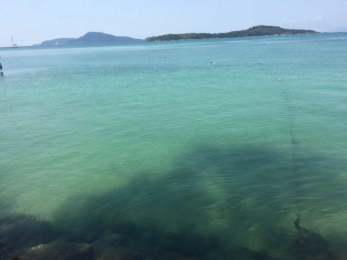
In calm seas and high water the bay at Rawai is an almost unreal turquoise – the water is so clear here that you can see the bottom. The view goes out to the offshore islands, with sailing boats appearing on the left.
The difference between this picture and everyday swimming is the water level: what looks like this at high tide is rock and mud at low tide. If you want photos, come in the morning – the boats are still lying quietly and the light is soft.
| Best time | early morning, in calm seas |
|---|
| Tides | check before you swim – no water at low tide |
|---|
| Photography | view of the islands, boats in the foreground |
Sirinat National Park: admission and rules
| Area | 90 km² on the north-west coast, from Mai Khao to Nai Yang and Nai Thon |
|---|
| Entry | foreign adults 200 THB, children 100 THB, collected at the checkpoints |
|---|
| Checkpoint Mai Khao | at the northern access, 08:30-16:30 |
|---|
| Checkpoint Nai Yang | at the northern end of the beach, 08:30-16:30 |
|---|
| Outside those hours | the beaches are open and no charge applies |
|---|
| Camping | campsite at Nai Yang, tents available on site |
|---|
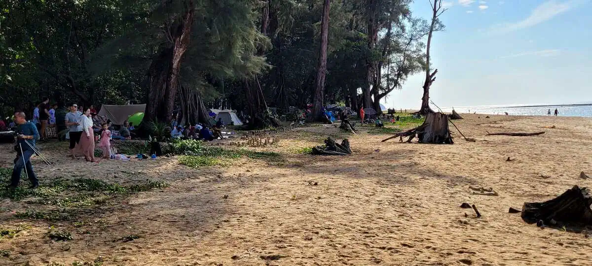
The park covers the last large stretch of casuarina woodland and mangrove on the island. The fee is charged where the park boundary crosses a beach access – not at every access, and not around the clock. If you are there before 08:30 or after 16:30 you will usually walk through without paying.
Do not read that as an invitation to dodge the fee: the money goes into the park, and the checkpoints are staffed at the times stated. Dogs, drones and vehicles are not allowed on the sand inside the park.
What services cost at the beaches (as of November 2026)
| Sunbeds, Patong / Karon / Kata | 2 sunbeds plus umbrella about 200 THB per day |
|---|
| Sunbeds, Kata Noi | 2 sunbeds plus umbrella 200 THB per day |
|---|
| Toilets, Kata | 20 THB |
|---|
| Toilets and showers, Kata Noi | 40 THB |
|---|
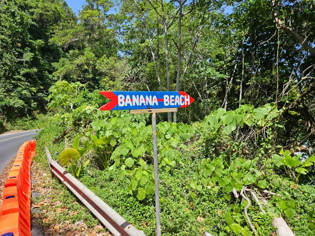
| Parking, Banana Beach | 100 THB per car (confirmed 5 November 2026) |
|---|
| Toilet, Banana Beach | 20 THB (confirmed 5 November 2026) |
|---|
| 4×4 shuttle, Nui Beach | about 200 THB return |
|---|
| Kayak, Ya Nui | about 100 THB per hour per person |
|---|
| Longtail boat, Laem Singh | about 100-200 THB per person |
|---|
| Beach entry | free everywhere – no beach in Thailand is private |
|---|
No beach charges admission. What costs money is the service around it: sunbeds, umbrellas, parking, toilets, boats. Everything is paid in cash, and the nearest cash machine is often a few kilometres away.
Where a figure is uncertain it says so. For scooters at Banana Beach there is no confirmed parking fee – guidebooks mention 40 to 50 THB, but that is not verified.
Plane spotting at Mai Khao: what is allowed
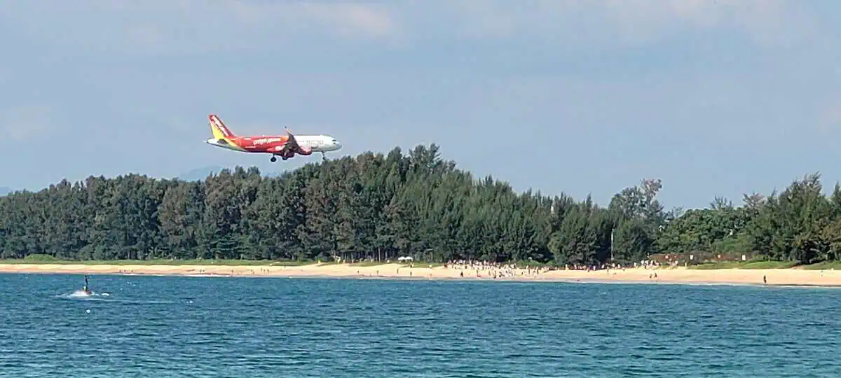
| Where | the southern end of Mai Khao, under the approach path |
|---|
| Height | aircraft come down at 30 to 50 metres |
|---|
| Best time | late afternoon, when the light comes from behind |
|---|
| Drones | prohibited – airport zone |
|---|
| Restricted zone | around the runway, signposted |
|---|
| Off limits | the fence and the approach lights |
|---|
The southern end of Mai Khao is one of the few places where you can stand almost directly under an aircraft on final approach. That is spectacular, and it is also regulated airside – the airport operator and the aviation authority both publish restrictions.
Do not fly drones, do not cross the fence, do not walk onto the approach lights. The photographs here were taken from the public beach.
Freedom Beach: the special case in 2026
| Access | longtail boat from Patong, 10-20 minutes, or the jungle path |
|---|
| Path | 15-25 min down, 20-35 min back up, steep |
|---|
| Admission | reported to have been dropped – carry cash anyway |
|---|
| Supervision | no lifeguards |
|---|
| Status | clearance order in July 2026 against 22 structures |
|---|
| Note | temporarily closed in August 2026 after a fatal accident |
|---|
Freedom Beach is the only beach on this list you cannot reach by road. The bay is enclosed by hills, the path is steep, and the water is clear enough for snorkelling at both rocky ends.
In 2026 the authorities included the beach in the campaign to recover public land: a clearance order was issued in July against 22 structures on around 9 rai of woodland, and in August the beach was closed temporarily after a fatal swimming accident. It was also promised that the access path would be repaired and no admission charged. Check the current situation before you set out – the status has changed repeatedly this year.
What applies at every beach in Phuket
| Red flag | no swimming – without exception |
|---|
| Amber flag | caution – swim only inside the marked area, if at all |
|---|
| Lifeguards | Patong, Karon, Kata, Kata Noi, Kamala, Nai Harn, Nui Beach (in season) |
|---|
| No lifeguards | Mai Khao, Nai Thon, Banana Beach, Laem Singh, Freedom Beach, Ao Sane, Tri Trang |
|---|
| Alcohol and swimming | do not combine them |
|---|
| Currents | May to October the west coast regularly has rip currents |
|---|
| Sun | strongest between 11 and 15 – shade is scarce at most beaches |
|---|
Every beach in Thailand is public. That also means nobody can charge you to set foot on the sand, and nobody can send you away from the waterline.
What is regulated is the commercial use of the beach – sunbeds, umbrellas, vendors, jet skis. That is why the situation at individual beaches changes from year to year: what was cleared in May 2025 may be back in 2026, and the other way round.
Viewpoints over the beaches
Three viewpoints lie directly on the route between the beaches. They cost nothing to enter and each takes 10 to 20 minutes.
Karon Viewpoint
The best-known view on the island: you see Kata Noi, Kata and Karon stacked below you all at once. Best in the late afternoon when the light comes in at an angle. Parking is right by the road and usually full.
Windmill Viewpoint
Above the south coast between Nai Harn and Ya Nui. From here you look across several bays at once, and at the wind turbines that give the spot its name. Considerably quieter than Karon Viewpoint.
Promthep Cape
The southern tip and the best-known sunset spot on the island. Correspondingly busy towards evening: allow time for the drive and for finding a space, or come an hour early and walk the last stretch.
Snorkeling and surfing at the beaches
Snorkeling
Three places are worth getting in from the shore: Ao Sane (three small coves with rocky ground), Ya Nui (rocks at both ends, Koh Man 300 metres out) and Freedom Beach (reef at both rocky ends).
Whether it actually works depends on visibility, current, swell and boat traffic. Only snorkel when conditions are right, keep your distance from corals and marine life, and with a red flag stay out of the water.
Surfen
During the monsoon months, roughly May to October, there can be surfable conditions at Kata, Kalim and Surin. That does not mean every day or every section suits beginners – ask at a local surf school about conditions, hazards and the right section.
Safety at the beaches
The sea along these beaches Phuket visitors swim from can turn quickly. In the rainy season strong waves and currents are normal, but hazards occur in other months too.
- With a red flag, stay out. No exceptions.
- Follow the lifeguards’ instructions and take local warnings seriously.
- Never leave children unsupervised near the water. Expect a current even with seemingly small waves.
- After heavy rain and with storm warnings change your plans.
- On rocky and unpaved paths wear sturdy shoes and allow extra care.
As of: the notes about red flags at Nai Harn and Patong refer to the days we visited in October 2026. That is no guarantee for tomorrow – check conditions on the ground. The weather is published by the Thai Meteorological Department and on Phuket weather.
Three routes to the beaches
Do not try to tick off all 21 beaches Phuket has on this coast in one day. Pick one area and adapt the order to where you are starting, the weather and what interests you.
Route 1: the north
Mai Khao to Nai Yang to Nai Thon
For travellers getting to know the north, with time for walks and a break in between. Afterwards the
James Bond Island tour from Ao Po pier fits in well.
Route 2: the central west coast
Bang Tao, Surin, Kamala, Kalim, Patong
A varied drive through very different holiday areas. Depending on how much time you have, pick individual stops and spend the evening in Patong.
Route 3: the south
Karon, Kata, Kata Noi, Karon Viewpoint, Nai Harn, Windmill Viewpoint, Promthep Cape
This route combines beaches and views. If you want longer at one beach, drop one or two stops.
Important: driving times depend on traffic, weather, the road layout and how long you stop. Not every destination lies on a continuous coastal road.
Scooter, hire car or driver
A hire car or a driver makes sense if you want to combine longer distances with several stops. If you drive yourself:
Check in advance whether your licence is valid for the vehicle class and recognised in Thailand.
- Clarify your insurance cover.
- Wear a proper helmet.
- Do not ride under the influence of alcohol or drugs.
- Avoid riding in severe storms, and do not leave the return until after dark.
More on this: hiring a scooter in Phuket and traffic rules in Thailand.
Conclusion: which beach suits which day
These beaches Phuket travellers ask about most are all on one coast, but they are not interchangeable: long empty stretches in the north, busy resorts in the middle, small coves and viewpoints in the south.
If you want quiet and space, go north at sunrise.
If you want infrastructure and no planning, stay in the middle and pick one of the large bays.
Do you want the clearest water and a view, go south, and accept the walk or the boat.
One honest line to finish: the best beach on this list is the one you reach before nine in the morning.
ML
Local tour guide and licensed tour operator, Phuket — on the island since 1995
Born on 1 January 1984 in Satun, Thailand, and living in Phuket since 1995. Bachelor of Arts in Tourism and Hospitality Management, Phuket Rajabhat University (2005), followed by work at the local tourist information centre. Self-employed tour operator for more than ten years.
- Over 30 years on Phuket — the routes, the light and the traffic here are daily life, not research.
- Tours are checked personally before they go on sale; this itinerary is one of the tours we run ourselves.
- The times, prices and pickup zones on this page are taken from the live booking form and re-checked on the date shown above.
Tourism business licence no. 33/11345, issued by Thailand’s Department of Tourism, valid 21 August 2026 to 20 August 2028. Registered business: TIP TOUR INFORMATION PHUKET, 17/59 Moo 1, Kathu, Kathu District, Phuket 83120. Verify the licence yourself — 30-second check on dot.go.th
Frequently asked questions about the beaches
|---|
|---|
|---|
|---|
|---|
|---|
|---|
|---|
|---|
|---|
|---|
|---|
|---|
|---|
|---|
|---|
|---|
|---|
|---|
|---|
|---|
|---|
|---|
|---|
|---|
|---|
|---|
|---|
|---|
|---|
|---|
|---|