Black Rock Viewpoint

The Black Rock Viewpoint is the one lookout on Phuket you still have to earn. There is no coach, no ticket booth and no handrail for the final stretch – only a washed-out clay track through the jungle, a footpath held together with sandbags and rope, and a summit that puts you above the south coast instead of in front of it. We went up on 13 November 2026, with a child, in the last hour of daylight.

On This Page

Black Rock Viewpoint at a glance

Black Rock Viewpoint (Pa Hin Dam), Karon – facts from our visit on 13 November 2026
Where it isKaron, above Nai Harn and Ao Sane, southern Phuket
Thai namePa Hin Dam (ผาหินดำ), “black cliff rock” – painted in white on the boulder beside the track
Entrancefree, no opening hours, nobody on site
Access roadunsurfaced clay track off Route 4030 – ground clearance and/or 4WD only, scooters need off-road practice
ShuttleATV operators at the junction will drive you up – we were quoted 100 baht per person
Parkingcar park at the junction; if you drive yourself, leave the car by the painted boulder
Final stretcharound 10 minutes uphill on a footpath – steep, roots, stone steps
Kitproper shoes, water, a torch for the way back
Facilitiesnone – no toilet, no water, no shop, neither at the top nor on the way
NavigationPlus Code Q7PX+GP9 Karon, Amphoe Mueang Phuket – maps list it as “Black Rock Viewpoint” or “Pa Hin Dam”
As ofFriday, 13 November 2026

Getting there: the turn-off on Route 4030

Route 4030 runs south from Patong through Karon and Kata. Shortly after the Karon Viewpoint, an unsurfaced track branches off to the left – the same track that drops down to Nui Beach. A car park with an ATV adventure outfit sits right at that corner, and that is where the sales pitch begins: 100 baht per person for the ride to the top.

We asked more than once whether we could take our own car up. The answer was yes – but only with the right vehicle. There is a reason the operators run quads.

Timing matters more than it looks. Go up an hour before sunset and the walk back happens in the dark. Every lookout on the island is listed in the Phuket viewpoints overview; this is the only one on that list with a genuine approach march.

Driving up: 4WD, scooter or the ATV shuttle

Beyond the junction the road up to the Black Rock Viewpoint is a clay track the rain has hollowed out: hard ridges, loose stones, gravel, and smooth channels where water still stands. We made it in a Honda CR-V with all-wheel drive. A standard saloon would not have cleared it – ground clearance and/or 4WD are not optional.

Scooters do get through, but this surface punishes inexperience. Off-road riding practice is a fair requirement, and one couple we met on a scooter turned around rather than risk it. If that sounds like you, take the shuttle or walk the track.

One thing that misled us: Google Street View from 2023 shows this road looking almost reasonable. It is not, at the moment. Those images also stop at the junction, so there is nothing more to inspect from a desk.

The boulder that marks the trailhead

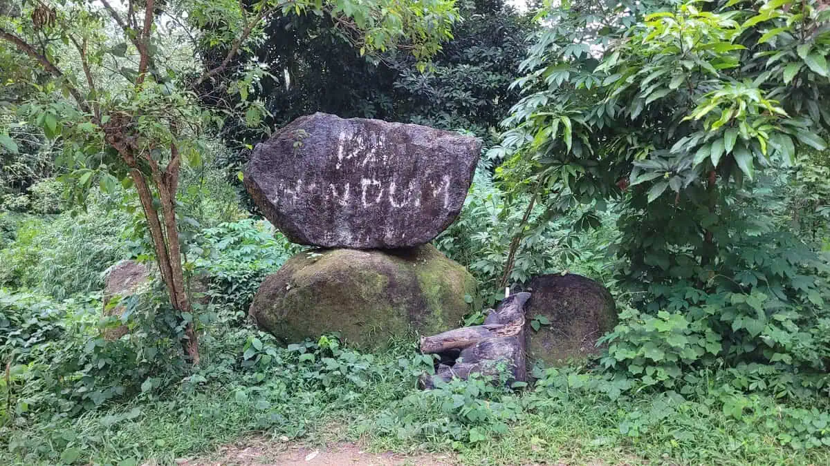
Roughly ten minutes up the clay track a large dark boulder stands on the right, painted in white with the words PA HIN DUM. That is the marker. A scooter was already parked beside it – someone had dared that far.

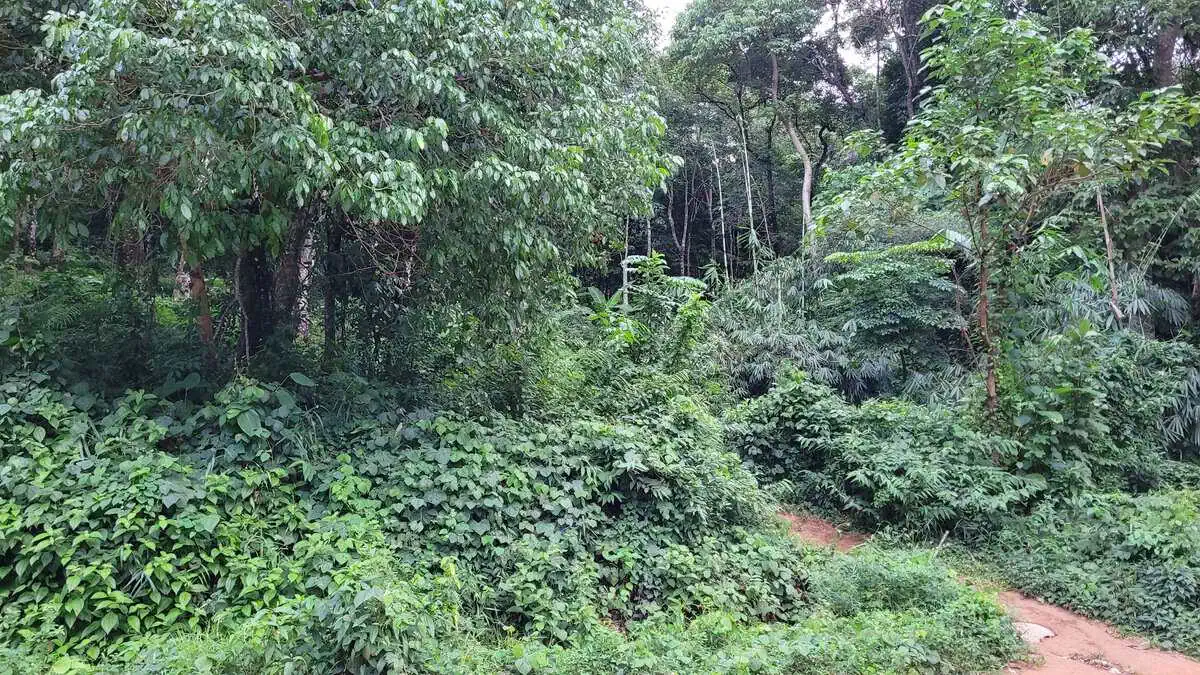
The start itself is easy to miss. On the left of the track, opposite the boulder, a narrow path disappears into the trees. Without knowing, you would take it for a villager’s shortcut. It is the only way up.

Large dark boulder painted with the words PA HIN DUM beside the dirt road to Black Rock Viewpoint
The boulder with the white lettering marks the trailhead. The footpath starts just behind it. Taken on 13 November 2026.
Narrow dirt footpath at the roadside leading into dense green jungle
The entrance on the left of the road: barely a foot wide, no sign. Easy to walk straight past.

Ten minutes of jungle trail

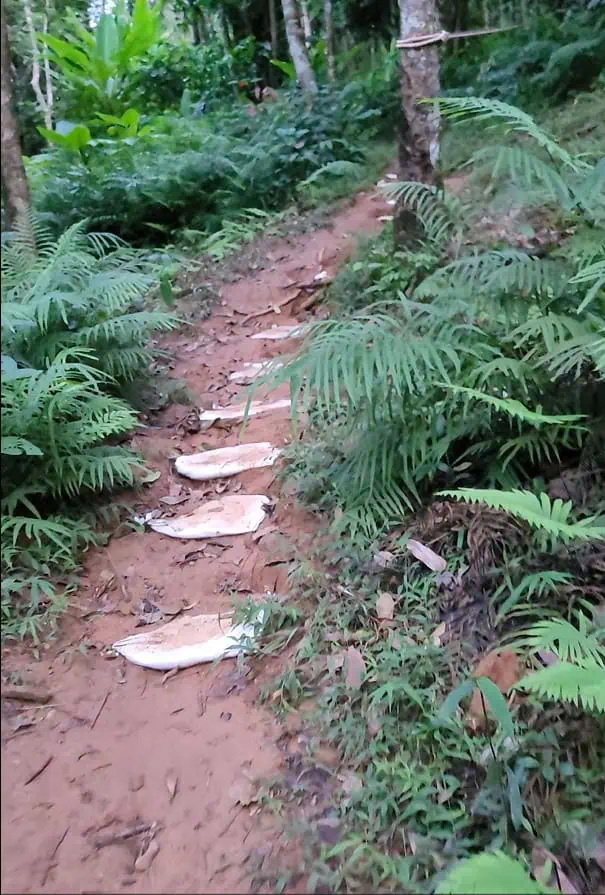
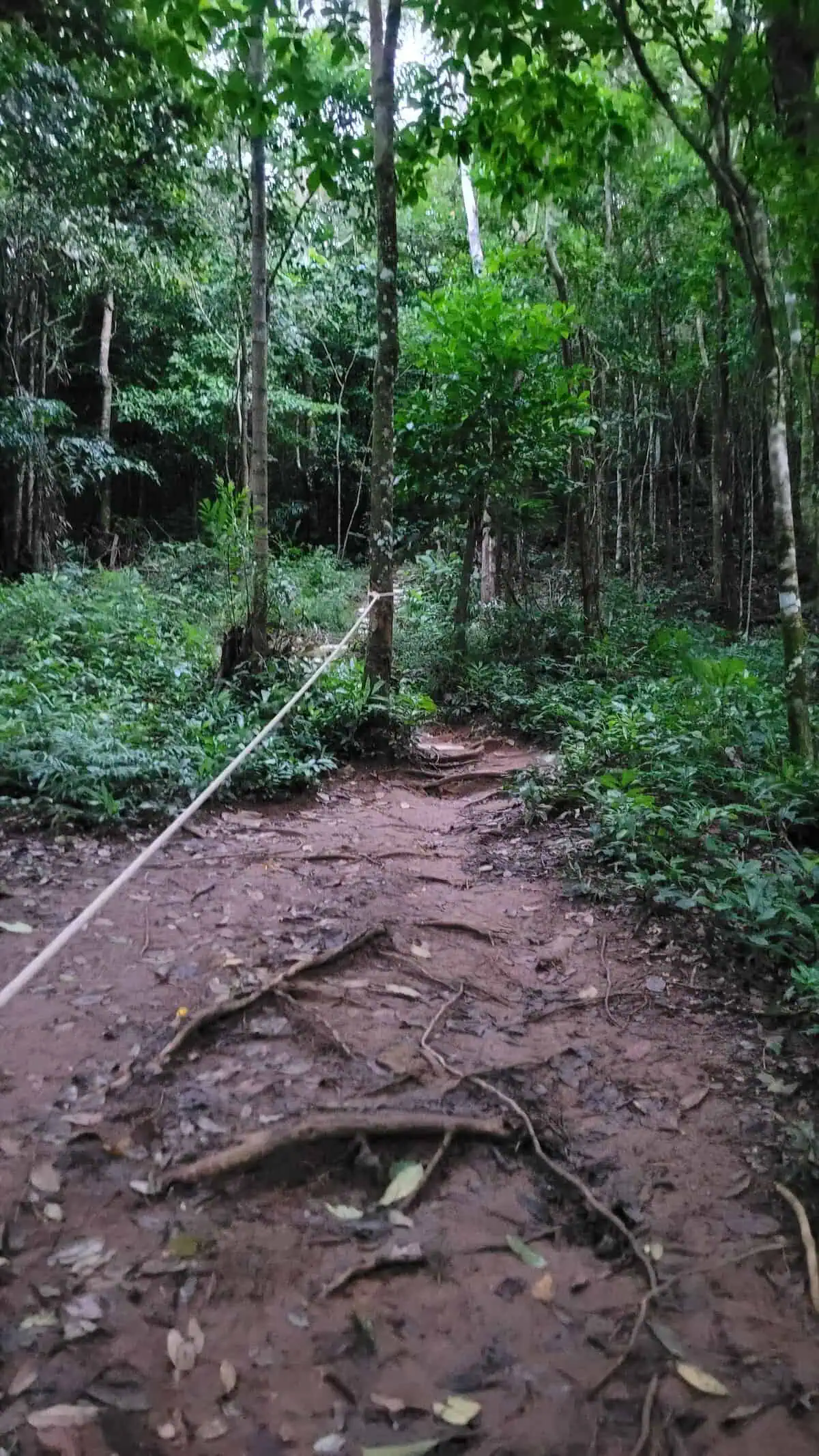
Short, but not gentle. The ground is red earth laced with roots, with pale stone slabs set into it. Where it gets steep, people have patched the trail by hand: sandbags laid as steps on one section, a rope strung between trees to hold on another.

With a child we needed about ten minutes. Without one it is quicker, but never effortless. Trainers with grip are the minimum – flip-flops on this path are a bad idea, especially on the way down.

Pale sandbags laid as steps in a dirt path between ferns at Black Rock Viewpoint
Sandbags form the steps on the steep section – without them the path would be almost impassable when wet.
Rope strung between two tree trunks as a handrail above a root-covered forest path
The rope between the trees is the only handhold. Below it: roots and loose soil.

At the top of the Black Rock Viewpoint: flag, rock and view

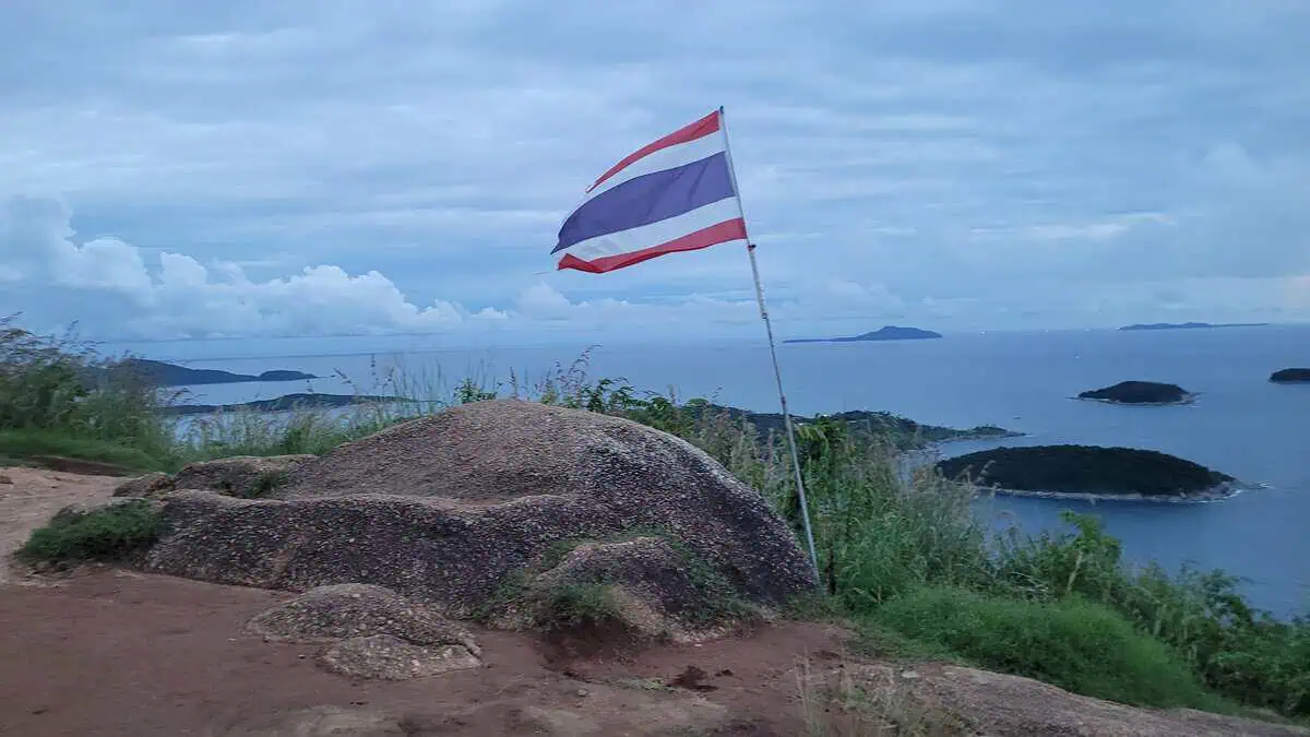
The first thing you see is the Thai flag beside the dark rock – it tells you where the viewpoint sits before the view itself appears. Then the ground opens out, bare rock ends, and the coast drops away.

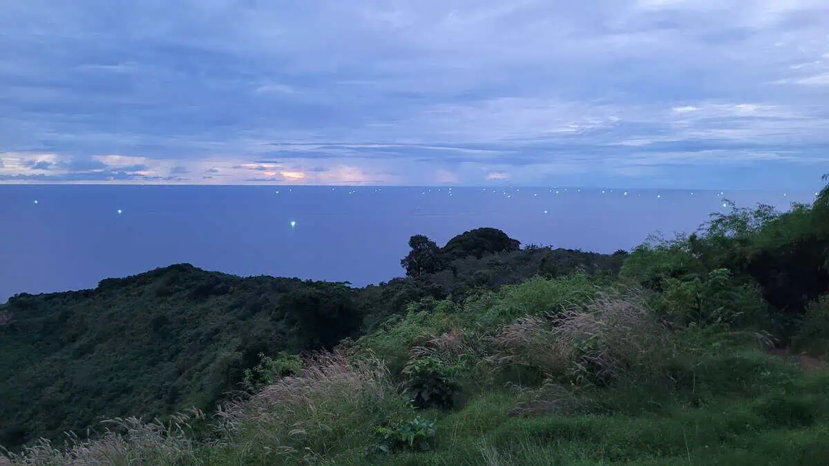
Straight ahead lies Nai Harn Bay with the islands offshore, the coastline curving away to the left. At sunset the lights of Promthep Cape come on along that headland – Phuket’s most famous lookout, reduced from up here to a distant string of lights. To the right the slope falls into jungle, and on the horizon the green lamps of the fishing fleet switch on one by one.

Our evening was heavily overcast, the sky carrying only a thin band of light above the water. It was still enough. What the Black Rock Viewpoint gives you is altitude: you are above the coastline, not standing in front of it.

Thai flag on a black rock at Black Rock Viewpoint with a view over the bay
The first thing you see at the top: the flag next to the rock that gives the viewpoint its name.
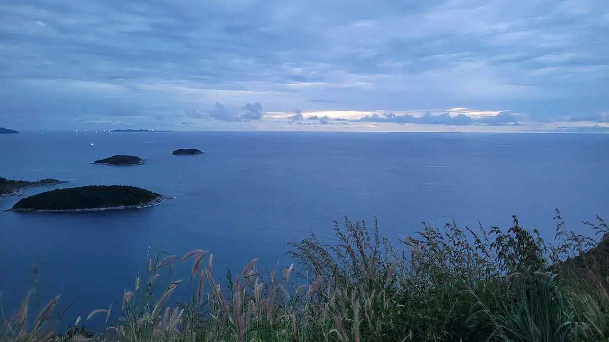
Wide view from Black Rock Viewpoint over the sea off southern Phuket with several dark islands offshore
Looking straight ahead: open sea, three islands in front, the coastline curving away to the left. No beach in sight from the edge – just water and forest.
Dusk over the sea with the lights of many fishing boats on the horizon and tall grasses in the foreground, seen from Black Rock Viewpoint
Looking to the right as it gets dark: the lights of the fishing boats on the horizon.

The descent in the dark

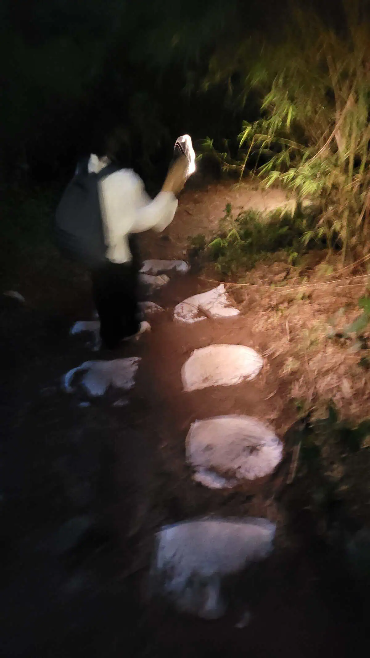
At the Black Rock Viewpoint it gets dark early – the slope faces away from the evening light and dusk here is short. Going down afterwards is a different walk. We used our phone torches, one step at a time, because root and stone look identical inside a small circle of light.

There is no lamp, no marking and no railing on the way down from the Black Rock Viewpoint. Anyone planning to stay for sunset should bring a proper head torch; a phone works, but it leaves you holding nothing when you want to take a photo.

Person lighting a rocky forest path downhill with a mobile phone torch
The descent by phone light: stones, roots, red earth. Don't attempt this section without a torch.
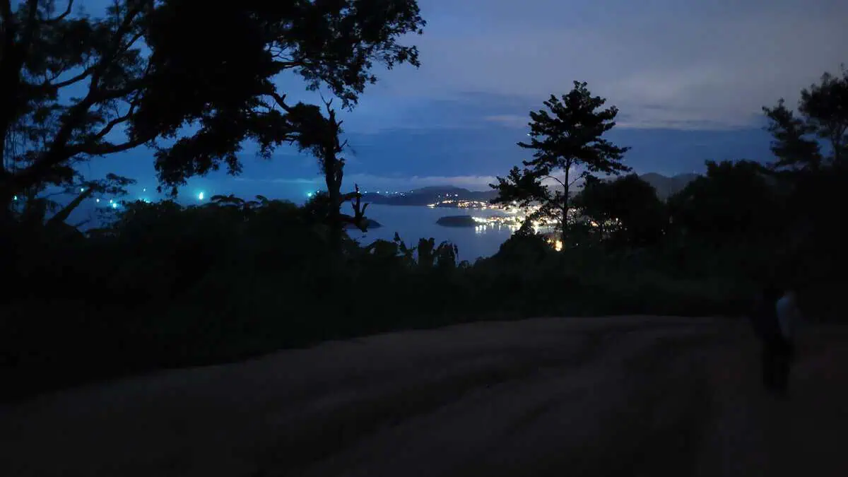
View of the dirt road at Black Rock Viewpoint and the lights of the bay at night, framed by tree canopies
Halfway down: the dirt road below, the lights of the bay beyond. The way back feels longer than the way up.

Back at the junction

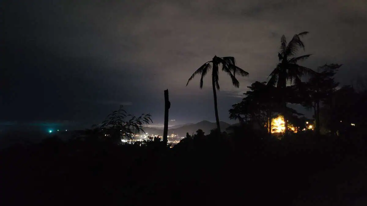
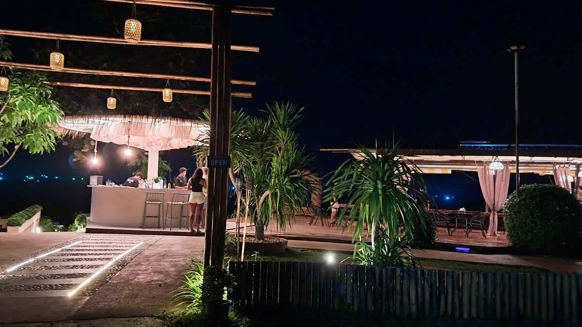
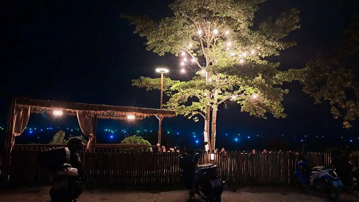
Once you are down, the calmest part of the evening begins. Palms turn into silhouettes, the coast becomes a line of lights, a few windows stay bright. And there is a café on the road that stays open for exactly this – fairy lights up in the tree, lanterns over the terrace, an OPEN sign on the frame.

Night view from the parking spot across illuminated palms towards the coast
Where the car was parked at night. From here the road leads back to Karon.
Lit café terrace with lanterns, a bamboo frame and guests at the bar
The terrace next door: lanterns above the bar, open sides, darkness beyond.
Roadside café at night with fairy lights in a large tree and parked scooters in front
Back at the junction the café was open, its tree lit up to the crown.

Practical notes

  • Timing: if you want daylight for the view and daylight for the way back, start at least two hours before sunset. We reached the boulder at 17:55 and the top at 18:04 – about as late as it makes sense.
  • Footwear: trainers with tread or hiking shoes. The path is slippery when wet, and the descent is the harder half.
  • Light: a head torch, or at minimum a full phone battery. There is no lighting anywhere on the route.
  • Water and snacks: nothing is sold up there and there is almost no shade. Bring what you need.
  • Children: doable – we were up in ten minutes with a child, and it was the highlight of their day. Hold hands near the edge; it is unguarded.
  • Vehicle: a rental car only with ground clearance and/or 4WD. Scooters need practice; this is not a road for beginners.
  • Shuttle: 100 baht per person is a fair price if you have the wrong vehicle. You can also politely decline and park at the junction anyway.
  • Navigation: enter Plus Code Q7PX+GP9 and don’t rely on Street View – those images are from 2023 and show a better road than exists today.

Our verdict

Was it worth it? Absolutely – and not in spite of the effort, but because of it. The Black Rock Viewpoint is not a place where you step out of the car and take the photo. You drive, you walk, you sweat, and then you stand above a coastline that the coaches down at Promthep never see from this angle.

The children’s highlight was not the view at all – it was the rope, the sandbags and the torch. For us it was the moment the fishing boats lit up. If you have an hour to spare and no proper shoes, skip it. Everyone else: go.

Frequently asked questions about the Black Rock Viewpoint

Is there an entrance fee for the Black Rock Viewpoint?

No. The viewpoint is freely accessible, with no ticket office and no opening hours. Money changes hands only if you take the shuttle offered by the ATV operators at the junction – we were quoted 100 baht per person.

Can I drive a rental car up to the trailhead?

Only with a suitable vehicle. The clay track is washed out, with hard ridges and loose stones; we made it in a Honda CR-V with all-wheel drive, a standard saloon would not have cleared it. Ground clearance and/or 4WD are the deciding factors.

How long does the climb to the Black Rock Viewpoint take?

About ten minutes on foot from the boulder, at a child’s pace. The path is short but steep, with roots and loose stone steps. Allow more time for the descent in the dark.

Is the trail suitable for children?

Yes, with supervision. We were up in ten minutes and it was the highlight of the day for our children. The final stretch is uneven and the edge at the top is unguarded, so keep hold of hands.

When is the best time to visit?

Late afternoon, when the light softens and you can catch sunset from the top – though that means walking down in the dark. To avoid it, start two hours earlier and you will be back at the car in daylight.

Where exactly is the Black Rock Viewpoint?

In Karon in southern Phuket, above Nai Harn and Ao Sane. The access track branches off Route 4030 shortly after the Karon Viewpoint. For navigation: Plus Code Q7PX+GP9 Karon, Amphoe Mueang Phuket.

Why is it called Black Rock Viewpoint?

After the dark rock at the summit. In Thai the place is known as Pa Hin Dam (ผาหินดำ), “black cliff rock”. The name is painted in white on the boulder beside the track, which doubles as the trail marker.

Are there toilets or anywhere to buy food?

No. Neither at the trailhead nor on the way up nor at the top is there a toilet, drinking water or food. The nearest option is the café on the road at the junction.
About this article

Montakarn Longsoh (Lee)

Local tour guide and licensed tour operator, Phuket — on the island since 1995

Born on 1 January 1984 in Satun, Thailand, and living in Phuket since 1995. Bachelor of Arts in Tourism and Hospitality Management, Phuket Rajabhat University (2005), followed by work at the local tourist information centre. Self-employed tour operator for more than ten years.

  • Over 30 years on Phuket — the routes, the light and the traffic here are daily life, not research.
  • Tours are checked personally before they go on sale; this itinerary is one of the tours we run ourselves.
  • The times, prices and pickup zones on this page are taken from the live booking form and re-checked on the date shown above.

Tourism business licence no. 33/11345, issued by Thailand’s Department of Tourism, valid 21 August 2026 to 20 August 2028. Registered business: TIP TOUR INFORMATION PHUKET, 17/59 Moo 1, Kathu, Kathu District, Phuket 83120. Verify the licence yourself — 30-second check on dot.go.th